

- Usage in publication:
-
- Anapra Formation
- Modifications:
-
- Mapped
- Dominant lithology:
-
- Sandstone
- Siltstone
- AAPG geologic province:
-
- Orogrande basin
Summary:
Pg. 19-20, geol. map. Anapra Formation of Washita Group. Quartzose sandstone and shaly siltstone. Subdivided into five informal members (not separately mapped), in ascending order: lower massive sandstone, 19 m (63 feet); lower shaly siltstone, about 18 m (60 feet); middle sandstone, 11 m (36 feet); upper shaly siltstone, about 11 m (36 feet); and upper sandstone, about 4.5 m (15 feet). Total thickness about 64 m (210 feet). Underlies Del Rio Formation and overlies Mesilla Valley Formation, both of Washita Group. Age is Early Cretaceous (Comanchean, early Cenomanian).
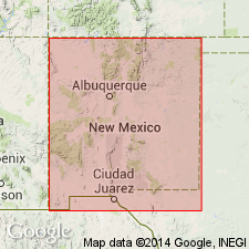
[Mapped in areas around the Cerro de Cristo Rey pluton, a volcanic intrusive body in Dona Ana Co., New Mexico, U.S.A., and Ciudad Juarez, Chihuahua, Mexico.]
Source: Publication.
- Usage in publication:
-
- Anapra Sandstone
- Modifications:
-
- Original reference
- Dominant lithology:
-
- Sandstone
- Shale
- AAPG geologic province:
-
- Orogrande basin
Summary:
Pg. 81-82. Anapra Sandstone. Orange, brown, thin-bedded to massive quartz sandstone with interlaminations of siliceous shale. Thickness 172.5 feet (52.56 m) thick at type. Conformably overlies Mesilla Valley Shale (new); conformably underlies Del Rio Clay. Is subdivision 7 in Bose's stratigraphic classification (Inst. Geol. Mexico Bol. 25, p. 26, 1910). Exposed mainly on north, east, and west sides of Cerro de Cristo Rey intrusion in Dona Ana County, New Mexico and Chihuahua, Mexico, where it forms highest ridges in sedimentary section around intrusion. Fossils are not abundant in unit though contains numerous EXOGYRA WHITNEYI Bose in upper 2 to 3 m. Age is Early Cretaceous (Cenomanian, Comanchean), based on stratigraphic position and probable correlation with Main Street Formation of northeast Texas. Base of Cenomanian placed at base of Anapra. [Author places lower part of Cenomanian in Lower Cretaceous.] Report includes geologic maps, cross sections, chart comparing nomenclature used in area.
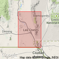
Type locality: on east side of road to Cerro de Cristo Rey, just east of abandoned RR siding of Bowen, in SW/4 SE/4 SW/4 sec. 9, T. 29 S., R. 4 E., [approx. Lat. 31 deg. 47 min. 40 sec. N., Long. 106 deg. 32 min. 36 sec. W.], Smeltertown 7.5-min quadrangle, Dona Ana Co., NM, just north of international bdry and west of NM-TX State line. Named from small community Anapra in Dona Ana Co., NM.
[Additional locality information from USGS historical topographic map collection TopoView, accessed November 19, 2022.]
Source: Publication; GNU records (USGS DDS-6; Denver GNULEX); US geologic names lexicon (USGS Bull. 1564, p. 3-4).
For more information, please contact Nancy Stamm, Geologic Names Committee Secretary.
Asterisk (*) indicates published by U.S. Geological Survey authors.
"No current usage" (†) implies that a name has been abandoned or has fallen into disuse. Former usage and, if known, replacement name given in parentheses ( ).
Slash (/) indicates name conflicts with nomenclatural guidelines (CSN, 1933; ACSN, 1961, 1970; NACSN, 1983, 2005, 2021). May be explained within brackets ([ ]).