- Usage in publication:
-
- Analomink red shale
- Modifications:
-
- Original reference
- Dominant lithology:
-
- Shale
- AAPG geologic province:
-
- Appalachian basin
Summary:
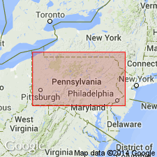
Red shale beneath Delaware River flags is named Analomink red shale for village in Monroe County, northeastern Pennsylvania, where at least 100 feet of it is well exposed. Overlies Trimmers Rock sandstone. Age is Late Devonian.
[See 1935 entry under Delaware River flags.]
Source: GNU records (USGS DDS-6; Reston GNULEX).

- Usage in publication:
-
- Analomink red shale
- Modifications:
-
- Principal reference
- AAPG geologic province:
-
- Appalachian basin
Summary:
Pg. 571, 588. Analomink red shale. A local unit of 100 feet of red beds at its type locality. It is probably confined to Pike and Monroe Counties, except doubtfull identification on New York side of Delaware River, near Hawks Nest. White [1881] mistook this red shale for his much younger New Milford red shale, from which it is separated by beds probably = lower Chemung and upper Portage. It is valuable only as defining base of Delaware River flags in this neighborhood. Where it is absent the Delaware River flags rest on Trimmers Rock sandstone. [Table on p. 571 shows following downward succession: Delaware River flags, Analomink red shale, and Trimmers Rock sandstone. Table on p. 606 shows Trimmers Rock sandstone = Delaware River and Analomink.]
Type locality: Analomink, Monroe Co., northeastern PA.
Source: US geologic names lexicon (USGS Bull. 896, p. 49).
For more information, please contact Nancy Stamm, Geologic Names Committee Secretary.
Asterisk (*) indicates published by U.S. Geological Survey authors.
"No current usage" (†) implies that a name has been abandoned or has fallen into disuse. Former usage and, if known, replacement name given in parentheses ( ).
Slash (/) indicates name conflicts with nomenclatural guidelines (CSN, 1933; ACSN, 1961, 1970; NACSN, 1983, 2005, 2021). May be explained within brackets ([ ]).

