

- Usage in publication:
-
- Anacacho formation*
- Modifications:
-
- Original reference
- Dominant lithology:
-
- Limestone
- Marl
- AAPG geologic province:
-
- Ouachita folded belt
Summary:
Pg. 240. Anacacho formation. Hard yellow and white limestones, with interbedded marls and occasional sandstone ledges. Thickness 279 feet. Overlies Austin chalk in Uvalde and Kinney Counties and occupies stratigrahic position of Taylor marls to east. [Age is Late Cretaceous (Gulf).]
[Named from the Anacacho Mountains, Kinney Co., southwestern TX, which are capped by the formation.]
Source: US geologic names lexicon (USGS Bull. 896, p. 48-49).

- Usage in publication:
-
- Anacacho Limestone
- Modifications:
-
- Mapped 1:250k
- Dominant lithology:
-
- Limestone
- Marl
- AAPG geologic province:
-
- Ouachita folded belt
Summary:
Formation is mapped in southeastern Kinney and southwestern Uvalde Counties, Texas. Described as a limestone and marl; limestone, reefy, thick-bedded, in part cross-bedded, light-yellow to yellow-brown and light-gray, fossiliferous; alternates with marl, light-gray to yellow; in part sandy, some volcanic rock fragments and weathered, rusty bentonite beds; marine megafossils abundant; thickness up to 500 feet, ends abruptly westward. [In the map explanation, the Anacacho is schematically depicted to wedge out within the San Miguel Formation; however, the San Miguel and Anacacho contact are not shown on the map.] Overlies (traversing westward) Austin Chalk, Upson Clay, and lower part of San Miguel Formation. Underlies (traversing eastward) upper part of San Miguel Formation and Olmos Formation. Age is Late Cretaceous.
Source: Modified from GNU records (USGS DDS-6; Denver GNULEX).

- Usage in publication:
-
- Anacacho Limestone
- Modifications:
-
- Mapped 1:250k
- Dominant lithology:
-
- Limestone
- Marl
- AAPG geologic province:
-
- Ouachita folded belt
Summary:
Pamphlet [p. 5]. Anacacho Limestone. Consists of alternating limestone and marl; limestone, light-yellow to yellow brown and light-gray, thick-bedded, in part cross-bedded, fossiliferous; marl, light-gray to yellow; in part sandy, some volcanic rock fragments and weathered, rusty bentonite beds; marine megafossils abundant. Thickness up to 500 feet; thins to feather edge in western Bexar County. Faulting common. Overlies, and in part correlative with, Austin Chalk and Pecan Gap Chalk. Underlies Escondido Formation; underlies Navarro Group and Marlbrook Marl ("upper Taylor marl"), undifferentiated, in western Bexar County. Age is Late Cretaceous.
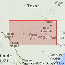
[Mapped in Uvalde, Medina, and Bexar Cos., southern TX. Not mapped east of San Antonio, Bexar Co., TX.]
Source: Publication.
For more information, please contact Nancy Stamm, Geologic Names Committee Secretary.
Asterisk (*) indicates published by U.S. Geological Survey authors.
"No current usage" (†) implies that a name has been abandoned or has fallen into disuse. Former usage and, if known, replacement name given in parentheses ( ).
Slash (/) indicates name conflicts with nomenclatural guidelines (CSN, 1933; ACSN, 1961, 1970; NACSN, 1983, 2005, 2021). May be explained within brackets ([ ]).