

- Usage in publication:
-
- Amphitheatre Basalt
- Modifications:
-
- Original reference
- Dominant lithology:
-
- Basalt
- AAPG geologic province:
-
- Alaska Southern region
Summary:
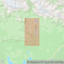
Pg. 4, 5, 15, 16, fig. 1. Amphitheatre Basalt. A dark-green massive fine-grained basalt containing some plagioclase phenocrysts. Thickness 2,000 feet on northeast side of Paxson Mountain (west of Paxson), and 3,500+ feet in other areas. Overlies Permian rocks near mouth of Eureka Creek. Underlies Triassic sediments in Valdez Creek area. Age is Triassic(?), based on stratigraphic relations and petrographic character.
[Type locality not designated.] Forms most of Amphitheatre [Amphitheater] Mountains, northwest of Paxson, in northwest part of Copper River basin, southeastern AK. Extends from Gakona River westward to Susitna River, nearly 100 mi.
Source: US geologic names lexicon (USGS Bull. 1350, p. 24); GNU records (USGS DDS-6; Menlo GNULEX).
- Usage in publication:
-
- Amphitheatre Basalt
- Modifications:
-
- Areal extent
- AAPG geologic province:
-
- Alaska Southern region
Summary:
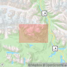
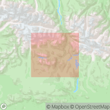
Amphitheatre basalt is shown on figure map in large area between East Maclaren and Maclaren glaciers, south of Eureka Creek, and below Denali fault near Gulkana glacier. Described as dark-green to gray vesicular to massive basalt with layered tuff and agglomerate locally present. Is presumed to dip northward beneath Triassic(?) argillite.
Source: GNU records (USGS DDS-6; Menlo GNULEX).
- Usage in publication:
-
- Amphitheatre Formation
- Modifications:
-
- Redescribed
- Areal extent
- Dominant lithology:
-
- Basalt
- Andesite
- AAPG geologic province:
-
- Alaska Southern region
Summary:
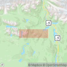
Amphitheatre basalt in Paxson area (Rose and Saunders, 1965) redescribed as Amphitheatre formation consisting of basalt and andesite. Shown on figure map of Mt. Hayes A-4 quad as occurring near Sugarloaf Mountain. Andesitic agglomerate; silicic tuff and tuffaceous sediments; basalt and andesite; and diabase and tuffaceous sediments lithologies shown separately on map. Is Triassic(?) age.
Source: GNU records (USGS DDS-6; Menlo GNULEX).
- Usage in publication:
-
- Amphitheatre Group
- Modifications:
-
- Revised
- AAPG geologic province:
-
- Alaska Southern region
Summary:
Amphitheatre Group. Amphitheatre Basalt of Rose (1966) elevated to group status in report by Smith (1973, ms in prep.). Sketch map of central part of Maclaren metamorphic belt shows weakly metamorphosed subaerial tholeiitic lavas of Amphitheatre Group with minor interstratified lenses of limestone, argillite, volcaniclastic debris and chert. Faunal assemblages collected in limestone beds within metabasalt sequences record a minimum Triassic age. Oldest rocks of Amphitheatre Group may correlate temporally with Permian volcanic rocks in eastern Alaska Range. Amphitheatre Group is intruded by granodiorite stock with K-Ar age of 125.8 +/-3.8 Ma.
Source: GNU records (USGS DDS-6; Menlo GNULEX).
- Usage in publication:
-
- Amphitheater Group
- Modifications:
-
- Revised
- AAPG geologic province:
-
- Alaska Southern region
Summary:
Divided into (ascending): Paxson Mountain Basalt, Tangle Lakes Formation and /Boulder Creek Volcanics (all new). Overlies Mankomen Group. Intruded by Fish Lake Complex. Age is Triassic. [Spelling of Amphitheatre changed to Amphitheater.]
[/Boulder Creek Volcanics preempted by Boulder Creek Quartz Monzonite of Rose (1967), also in Mt. Hayes quadrangle, AK.]
Source: GNU records (USGS DDS-6; Menlo GNULEX).
For more information, please contact Nancy Stamm, Geologic Names Committee Secretary.
Asterisk (*) indicates published by U.S. Geological Survey authors.
"No current usage" (†) implies that a name has been abandoned or has fallen into disuse. Former usage and, if known, replacement name given in parentheses ( ).
Slash (/) indicates name conflicts with nomenclatural guidelines (CSN, 1933; ACSN, 1961, 1970; NACSN, 1983, 2005, 2021). May be explained within brackets ([ ]).