

- Usage in publication:
-
- Amos Wash Member
- Modifications:
-
- Named
- Dominant lithology:
-
- Mudstone
- Claystone
- AAPG geologic province:
-
- Basin-and-Range province
Summary:
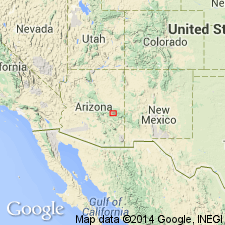
Named as the basal member (of 4) of Supai Formation for Amos Wash. No type locality designated. Section 330 ft thick measured west of Whiteriver-San Carlos road 3 mi south of Amos Wash road junction, sec 10, T4 1/2N, R21E, Gila Co, AZ, Basin-and-Range province, where member overlies Naco Formation and underlies Big A Butte Member (named) of Supai. Lower contact placed at base of a gray, thin-bedded, highly calcareous, slope-forming claystone. Upper contact placed at base of 2 ft thick gray argillaceous limestone. Second section 131+ ft thick measured on ridge, 1 1/2 mi southwest of Amos Road junction, sec 29, T5N, R21E. Above the basal gray claystone, member consists of mostly red-brown, thin-bedded mudstone that is interbedded with gray and red-brown, thin-bedded, slope-forming claystone, and very minor amounts of red-brown, thin-bedded siltstone and sandstone. Of continental origin. Correlation chart. Of Early Permian, Wolfcampian age.
Source: GNU records (USGS DDS-6; Denver GNULEX).
For more information, please contact Nancy Stamm, Geologic Names Committee Secretary.
Asterisk (*) indicates published by U.S. Geological Survey authors.
"No current usage" (†) implies that a name has been abandoned or has fallen into disuse. Former usage and, if known, replacement name given in parentheses ( ).
Slash (/) indicates name conflicts with nomenclatural guidelines (CSN, 1933; ACSN, 1961, 1970; NACSN, 1983, 2005, 2021). May be explained within brackets ([ ]).