The National Geologic Map Database is migrating to a new infrastructure. We apologize for any service disruptions during this process.
|
|---|


- Usage in publication:
-
- Amnicon formation
- Modifications:
-
- Original reference
- Dominant lithology:
-
- Shale
- Sandstone
- Conglomerate
- AAPG geologic province:
-
- Wisconsin arch
Summary:
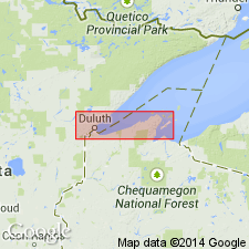
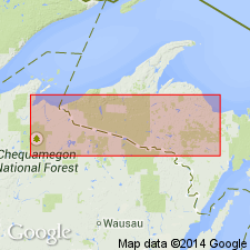
Pg. 50, 54. Amnicon formation of Oronto group. Red and greenish shales, arkosic sandstone, and some conglomerate. Thickness 5,000 feet; 1,050 feet exposed. Top formation of Oronto group. Overlies Eileen sandstone and conformably underlies Bayfield sandstone group. Recognized in Douglas and Bayfield Counties, northwestern Wisconisn. Exposed on Fish Creek, near Ashland, and on Middle and St. Louis Rivers in Douglas County. Age is pre-Cambrian (late Keweenawan).
[Origin of name not stated. According to map the rocks of American River region are Orienta sandstone and trap rocks.]
Source: US geologic names lexicon (USGS Bull. 896, p. 47).
- Usage in publication:
-
- Amnicon formation
- Modifications:
-
- Revised
- AAPG geologic province:
-
- Wisconsin arch
Summary:
Pg. 1474-1479. Amnicon formation. Thwaites (1912) assumed that Eileen sandstone (in Oronto group) lay below Amnicon sandstone on basis of distribution of outcrops and strike and dip. Eileen at type locality is not in contact with any other formation of Oronto series but is separated by unexposed interval of almost 1.5 miles from Amnicon formation. Therefore relation of Eileen and Amnicon is not definitely known at type locality, and sequence postulated by Thwaites is only one of several possible explanations of relation of these two sandstones. Lithological and heavy-mineral evidence suggest that Eileen sandstone belongs above the Amnicon and includes beds on Middle River and Fish Creek sections that Thwaites classes as lower Orienta (in Bayfield group). The Eileen, which resembles Bayfield group of sandstones, is probably basal Orienta, and Amnicon arkose is upper Freda. Thickness of Amnicon as given by Thwaites --5,000 feet-- included his estimate of thickness of Freda. Hence, Oronto group revised to exclude Eileen and Amnicon sandstones.
Source: US geologic names lexicon (USGS Bull. 1200, p. 82).
For more information, please contact Nancy Stamm, Geologic Names Committee Secretary.
Asterisk (*) indicates published by U.S. Geological Survey authors.
"No current usage" (†) implies that a name has been abandoned or has fallen into disuse. Former usage and, if known, replacement name given in parentheses ( ).
Slash (/) indicates name conflicts with nomenclatural guidelines (CSN, 1933; ACSN, 1961, 1970; NACSN, 1983, 2005, 2021). May be explained within brackets ([ ]).