The National Geologic Map Database is migrating to a new infrastructure. We apologize for any service disruptions during this process.
|
|---|


- Usage in publication:
-
- Ammons Formation
- Modifications:
-
- Named
- Dominant lithology:
-
- Schist
- Metasiltstone
- Metasandstone
- Sandstone
- Siltstone
- AAPG geologic province:
-
- Piedmont-Blue Ridge province
Summary:
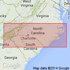
Ammons Formation of Great Smoky Group here named in Swain Co., west-central NC. Consists 1200 to 1500 m of thin-bedded laminated metasandstone, metasiltstone, and schist. Includes Horse Branch Member (new name), a 300-m-thick unit of black schist. Ammons correlates with Hothouse Formation of Hurst (1955). Conformably underlies Dean Formation and overlies Grassy Branch Formation, both of Great Smoky Group or underlies Nantahala Formation. Age is late Precambrian (Z).
Source: GNU records (USGS DDS-6; Reston GNULEX).
- Usage in publication:
-
- Ammons Formation
- Modifications:
-
- Overview
- AAPG geologic province:
-
- Piedmont-Blue Ridge province
Summary:
Metasandstone, metagraywacke, metasiltstone, and mica schist are lumped together as one unit within Late Proterozoic Great Smoky Group in Blue Ridge belt. Unit includes Hughes Gap and Hothouse Formations in southern area, Horse Branch Member of Ammons Formation and Grassy Branch Formation in northern area. [Copied from map text, is ambiguous about the rest of the Ammons.]
Source: GNU records (USGS DDS-6; Reston GNULEX).
For more information, please contact Nancy Stamm, Geologic Names Committee Secretary.
Asterisk (*) indicates published by U.S. Geological Survey authors.
"No current usage" (†) implies that a name has been abandoned or has fallen into disuse. Former usage and, if known, replacement name given in parentheses ( ).
Slash (/) indicates name conflicts with nomenclatural guidelines (CSN, 1933; ACSN, 1961, 1970; NACSN, 1983, 2005, 2021). May be explained within brackets ([ ]).