The National Geologic Map Database is migrating to a new infrastructure. We apologize for any service disruptions during this process.
|
|---|


- Usage in publication:
-
- Ammonia Tanks Member*
- Modifications:
-
- Mapped
- AAPG geologic province:
-
- Great Basin province
Summary:
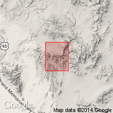
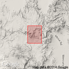
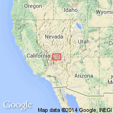
Mapped in Topopah Spring NW 7.5' quad, Nye Co, NV in small outcrop one mi northwest of Pinnacles Ridge. Is 20 to 75 ft thick. Underlies rhyolite of Pinnacles Ridge, Pliocene tuffaceous sandstone and gravel and Quaternary alluvium. Assigned Pliocene age.
Source: GNU records (USGS DDS-6; Denver GNULEX).
- Usage in publication:
-
- Ammonia Tanks Member*
- Modifications:
-
- Original reference
- Dominant lithology:
-
- Tuff
- AAPG geologic province:
-
- Great Basin province
Summary:
Pg. A50-A51. Ammonia Tanks Member of Timber Mountain Tuff of Piapi Canyon Group. A composite cooling unit of rhyolitic to quartz latitic ash-flow tuff which locally reaches thickness of almost 300 feet in vicinity of Pahute Mesa. Thickness 250 feet at type locality. Overlies Rainier Mesa Member of Timber Mountain Tuff. In Frenchman Flat area, underlies basalt of Skull Mountain. Age is Pliocene, about 10.5 Ma (R.W. Kistler, written commun., 1963).
Type locality [area]: about 0.25 mi north of Ammonia Tanks, Nevada Test Site, and continuing for several mi along south rim of Pahute Mesa, Nye Co., southern NV. Named from Ammonia Tanks.
Source: US geologic names lexicon (USGS Bull. 1350, p. 23-24); supplemental information from GNU records (USGS DDS-6; Reston GNULEX).
- Usage in publication:
-
- Ammonia Tanks Member*
- Modifications:
-
- Mapped
- AAPG geologic province:
-
- Great Basin province
Summary:
Mapped in Thirsty Canyon SE 7.5' quad, Nye Co, NV in scattered outcrops in western part of quad. Divided into upper and lower parts shown separately on map. Upper part (0 to 100 ft thick) described as red-brown crystalline where thick with large black fiamme near base, cobble-size lithic inclusions locally abundant and containing 30 percent phenocrysts. Lower part (50 ft thick) is gray-brown crystalline densely welded at top; grades down to gray glassy nonwelded base. Unconformably overlies tuff of Camp Transvaal; unconformably underlies tuff of Cutoff Road and Spearhead Member of Thirsty Canyon Tuff. Is Pliocene age.
Source: GNU records (USGS DDS-6; Denver GNULEX).
- Usage in publication:
-
- Ammonia Tanks Member*
- Modifications:
-
- Mapped
- Dominant lithology:
-
- Ash-flow tuff
- AAPG geologic province:
-
- Great Basin province
Summary:
Ammonia Tanks Member, upper member of Timber Mountain Tuff. Mapped in Scrugham Peak 7.5-min quadrangle, Nye County, Nevada. Thickness as much as 250 feet. Composed of compound cooling unit of three ash-flow subunits (shown separately). Upper subunit is quartz latitic, local and thin nonwelded to densely welded, dark-yellowish-orange to nearly black glassy tuff containing dark mafic scoria pumice, grading to flattened black glass as much as 2 feet in length, and sparse white and yellow rhyolitic pumice. Xenoliths common, including rhyolite and fragments from Rainier Mesa Member. Middle subunit is rhyolitic and similar to upper subunit except with slightly fewer phenocrysts, less welded and commonly consists of pale-purplish-gray devitrified vapor-phase zone. Lower subunit (exposed only in caldera moat) is rhyolitic partly welded pale-purplish devitrified zone underlain by partly welded tuff, grading downward to nonwelded pink glassy tuff with white pumice as large as 1 inch. Age is Pliocene.
Source: GNU records (USGS DDS-6; Menlo GNULEX); US geologic names lexicon (USGS Bull. 1350, p. 23-24).
- Usage in publication:
-
- Ammonia Tanks Member*
- Modifications:
-
- Mapped
- AAPG geologic province:
-
- Great Basin province
Summary:
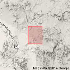
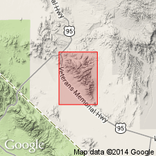
Mapped in Ammonia Tanks 7.5' quad, Nye Co, NV where unit is as much as 550 ft thick. Separated from underlying Rainier Mesa Member (of Timber Mountain Tuff) by tuff of Falcon Canyon (informal unit of Timber Mountain Tuff); also unconformably overlies rhyolite of Split Ridge. Unconformably underlies Spearhead Member of Thirsty Canyon Tuff and Quaternary colluvium. Is Pliocene age.
Source: GNU records (USGS DDS-6; Denver GNULEX).
- Usage in publication:
-
- Ammonia Tanks Member*
- Modifications:
-
- Geochronologic dating
- AAPG geologic province:
-
- Great Basin province
Summary:
K-Ar ages on biotite and sanidine range from 12.1 to 10.8 Ma.
Source: GNU records (USGS DDS-6; Reston GNULEX).
- Usage in publication:
-
- Ammonia Tanks Member*
- Modifications:
-
- Areal extent
- Age modified
- AAPG geologic province:
-
- Great Basin province
Summary:
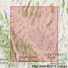
Mapped in Esmeralda County, NV, where ash flows of Ammonia Tanks Member (Timber Mountain Tuff) apparently spilled northward into Oriental Wash through gap in Gold Mountain. Age is Miocene based on K-Ar determination of 11.5 to 10.5 Ma (R.W. Kistler, 1968).
Source: GNU records (USGS DDS-6; Reston GNULEX).
- Usage in publication:
-
- Ammonia Tanks Member*
- Modifications:
-
- Revised
- AAPG geologic province:
-
- Great Basin province
Summary:
Tuff of Cat Canyon (of Byers and others, 1968) is now considered part of Ammonia Tanks Member (Byers, oral commun., Feb., 1972). Thickness of Ammonia Tanks Member is at least 3,000 feet in center of Timber Mountain caldera. Considered early Pliocene based on K-Ar determinations of Kistler (1968). [Note: this is time scale previous to 1983]
Source: GNU records (USGS DDS-6; Reston GNULEX).
- Usage in publication:
-
- Ammonia Tanks Member*
- Modifications:
-
- Revised
- AAPG geologic province:
-
- Great Basin province
Summary:
Revised to include two informal units: "tuff of Cat Canyon" on Timber Mountain resurgent dome (of Carr and Quinlivan, 1966) and "tuff of Transvaal" (of Orkild, 1966; = "tuff of Camp Transvaal" of Lipman and others, 1966). Generalized isopach map of Ammonia Tanks Member (Timber Mountain Tuff) shows unit overlies pre-Ammonia Tanks rhyolite lavas. Underlies tuff of Buttonhook Wash.
Source: GNU records (USGS DDS-6; Reston GNULEX).
- Usage in publication:
-
- Ammonia Tanks Member*
- Modifications:
-
- Age modified
- AAPG geologic province:
-
- Great Basin province
Summary:
Unit age in report area [Bare Mountain, Nye Co, NV] revised from Miocene to: middle Miocene based on age revision of the Timber Mountain Tuff, locally.
Source: GNU records (USGS DDS-6; Reston GNULEX).
- Usage in publication:
-
- Ammonia Tanks Member*
- Modifications:
-
- Areal extent
- AAPG geologic province:
-
- Great Basin province
Summary:
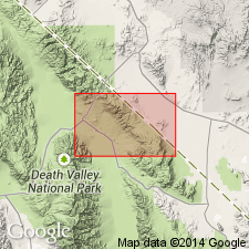
Unit geographically extended into report area [hilly area adjacent to east flank of northern Funeral Mountains, Inyo Co, CA]. Age given as Miocene.
Source: GNU records (USGS DDS-6; Reston GNULEX).

- Usage in publication:
-
- Ammonia Tanks Tuff*
- Modifications:
-
- Revised
- AAPG geologic province:
-
- Great Basin province
Summary:
Ammonia Tanks Member of the Timber Mountain Tuff is raised in rank to the Ammonia Tanks Tuff of the Timber Mountain Group. Age is Miocene.
Source: GNU records (USGS DDS-6; Reston GNULEX).
For more information, please contact Nancy Stamm, Geologic Names Committee Secretary.
Asterisk (*) indicates published by U.S. Geological Survey authors.
"No current usage" (†) implies that a name has been abandoned or has fallen into disuse. Former usage and, if known, replacement name given in parentheses ( ).
Slash (/) indicates name conflicts with nomenclatural guidelines (CSN, 1933; ACSN, 1961, 1970; NACSN, 1983, 2005, 2021). May be explained within brackets ([ ]).