The National Geologic Map Database is migrating to a new infrastructure. We apologize for any service disruptions during this process.
|
|---|


- Usage in publication:
-
- Ames limestone
- Modifications:
-
- Original reference
- Dominant lithology:
-
- Limestone
- Shale
- AAPG geologic province:
-
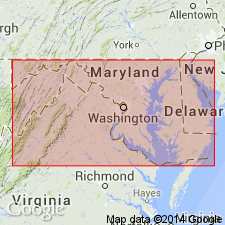
- Appalachian basin
Summary:
Pg. 235, 271, 296. Ames limestone. Fossiliferous limestone, 1 to 5 feet thick, in Coal Measures of Morgan, Athens, and Gallia Counties, Ohio, about 140 feet below horizon of Federal Creek or Pomeroy coal.
Source: US geologic names lexicon (USGS Bull. 896, p. 46).
- Usage in publication:
-
- Ames limestone
- Modifications:
-
- Areal extent
- AAPG geologic province:
-
- Appalachian basin
Summary:
Ames limestone is used for former "crinoidal" and "green fossiliferous" limestones in OH, PA, and WV where it serves as a stratigraphic key. Consists of gray and greenish-gray limestone, usually a single 3 foot bed.
Source: GNU records (USGS DDS-6; Reston GNULEX).

- Usage in publication:
-
- Ames limestone member*
- Modifications:
-
- Adopted
- AAPG geologic province:
-
- Appalachian basin
Summary:
Ames limestone member of Conemaugh formation. Adopted as member of Conemaugh formation. Replaces "Crinoidal limestone" of early reports. In West Virginia Survey reports the names Upper Ames limestone and Lower Amers limestone are used, for limestones 4 and 3 feet thick, respectively, separated by 10 to 20 feet of green shale called Ames shale. (See R.V. Hennen and D.B. Reger, West Virginia Geol. Survey Rpt. Preston Co., 1914, and Rpt. Marion, Monongalia, and Taylor Cos., 1918.)
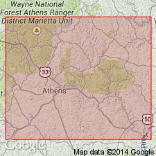
Named from exposures near village of Amesville, Ames Twp., Athens Co., southeastern OH.
Source: US geologic names lexicon (USGS Bull. 896, p. 46).
- Usage in publication:
-
- Ames limestone
- Modifications:
-
- Revised
- AAPG geologic province:
-
- Appalachian basin
Summary:
Ames limestone is considered middle formation of Conemaugh Group. It underlies Casselman Formation and overlies the Glenshaw Formation.
Source: GNU records (USGS DDS-6; Reston GNULEX).
- Usage in publication:
-
- Ames Limestone Member*
- Modifications:
-
- Age modified
- Biostratigraphic dating
- AAPG geologic province:
-
- Appalachian basin
Summary:
Conodonts indicate a late Virgilian age for Ames Limestone Member of Glenshaw Formation in PA. Paleoenvironments of the Ames range from shallow marine to deltaic. The stratigraphic boundaries of the Ames are the top of the highest limestone or shale with marine microfossils and the bottom of the lowest limestone or shale with marine microfossils.
Source: GNU records (USGS DDS-6; Reston GNULEX).
- Usage in publication:
-
- Ames Limestone Member*
- Modifications:
-
- Areal extent
- AAPG geologic province:
-
- Appalachian basin
Summary:
In western MD, the Ames Limestone Member of the Conemaugh Formation overlies the Brush Creek Limestone Member and is dominantly a shale.
Source: GNU records (USGS DDS-6; Reston GNULEX).
- Usage in publication:
-
- Ames Member
- Modifications:
-
- Areal extent
- AAPG geologic province:
-
- Appalachian basin
Summary:
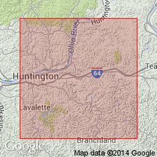
Most persistent marine bed of the Conemaugh. The top of the Ames is used to separate the Conemaugh into a lower Glenshaw Formation that contains marine beds and an upper Casselman Formation that generally does not. Member is 0.5 to 2.0 m thick over most of the outcrop belt in OH and is composed mostly of limestone. In southernmost OH and adjacent WV and KY as well as in eastern PA, northeastern WV and MD, the Ames is mostly shale and locally exceeds 10 m. Shales of the Ames become siltier upward and the fossil content declines and disappears. Between Huntington, WV, and Louisa, KY, the Ames loses its marine character. Ames lithofacies in the Huntington area are dominated by terrigenous materials. Base is defined by a thin coal and just above the Ames is a "key bed" consisting of dark, bluish-green, siderite-cemented sandstone that weathers rounded and blood-red. It is present no matter what the lithology of the Ames. In the Huntington area, the Ames is divided into three lithosomes: a basal green chonetid shale, a middle red platy shale, and upper calcareous crinoidal sandstone. These deposits are entirely of nearshore origin. Shoreline was somewhere in the 12 km interval between the southernmost locality in the study area and Louisa, KY.
Source: GNU records (USGS DDS-6; Reston GNULEX).
For more information, please contact Nancy Stamm, Geologic Names Committee Secretary.
Asterisk (*) indicates published by U.S. Geological Survey authors.
"No current usage" (†) implies that a name has been abandoned or has fallen into disuse. Former usage and, if known, replacement name given in parentheses ( ).
Slash (/) indicates name conflicts with nomenclatural guidelines (CSN, 1933; ACSN, 1961, 1970; NACSN, 1983, 2005, 2021). May be explained within brackets ([ ]).