The National Geologic Map Database is migrating to a new infrastructure. We apologize for any service disruptions during this process.
|
|---|


- Usage in publication:
-
- American Ravine andesite
- Modifications:
-
- Overview
- AAPG geologic province:
-
- Great Basin province
Summary:
American Ravine andesite listed in table of rocks of Comstock Lode [Lyon County, Nevada]. [Underlies] Miocene(?) Hartford Hills rhyolite. [Overlies] Jurassic monzonite. Thickness 600 feet. Age is Miocene(?) [no basis].
Source: Modified from GNU records (USGS DDS-6; Menlo GNULEX).
- Usage in publication:
-
- American Ravine andesite
- Modifications:
-
- Named
- Dominant lithology:
-
- Andesite
- Porphyry
- AAPG geologic province:
-
- Great Basin province
Summary:
Pg. 33, 44-50, 50-52, pl. 1; see also V.P. Gianella, 1936, Mining and Metallurgy, v. 15, no. 331, p. 209 (table 1). American Ravine andesite. Light-gray felsitic hornblende andesite about 500 feet thick. Underlies Hartford Hill rhyolite; overlies fanglomerate, monzonite, or metamorphic rocks. Becker (1882) mapped this rock as felsitic quartz porphyry. Age is Eocene, based on stratigraphic relations.
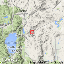
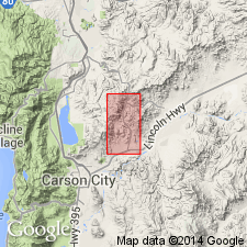
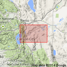
Notable exposures on east side of Virginia Range, near Virginia City, NV. [Probably named from American Ravine west of Silver City, Silver City district, south end of Virginia Range, 12 mi northeast of Carson City, Lyon Co., NV.]
Source: US geologic names lexicon (USGS Bull. 1200, p. 76-77); GNU records (USGS DDS-6; Menlo GNULEX).
- Usage in publication:
-
- American Ravine andesite porphyry*
- Modifications:
-
- Adopted
- Age modified
- AAPG geologic province:
-
- Great Basin province
Summary:
American Ravine andesite (Gianella, 1936) adopted as the American Ravine andesite porphyry. Intrusive into rhyolite [mainly Eocene] and probably into lower part of Alta andesite [Miocene]. Age therefore changed from Eocene to Miocene(?).
Source: GNU records (USGS DDS-6; Menlo GNULEX).
- Usage in publication:
-
- American Ravine Andesite Porphyry*
- Modifications:
-
- Age modified
- AAPG geologic province:
-
- Great Basin province
Summary:
Age of the American Ravine Andesite Porphyry is revised from Miocene(?) to: Miocene [based on local stratigraphic relations in the Comstock Lode district in western Virginia Range].
Source: GNU records (USGS DDS-6; Menlo GNULEX).
For more information, please contact Nancy Stamm, Geologic Names Committee Secretary.
Asterisk (*) indicates published by U.S. Geological Survey authors.
"No current usage" (†) implies that a name has been abandoned or has fallen into disuse. Former usage and, if known, replacement name given in parentheses ( ).
Slash (/) indicates name conflicts with nomenclatural guidelines (CSN, 1933; ACSN, 1961, 1970; NACSN, 1983, 2005, 2021). May be explained within brackets ([ ]).