- Usage in publication:
-
- Amazonia limestone bed*
- Modifications:
-
- Original reference
- Dominant lithology:
-
- Limestone
- Shale
- AAPG geologic province:
-
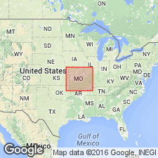
- Forest City basin
Summary:
Pg. 31, 170, 179. Amazonia limestone bed of Lawrence shale member of Douglas formation. A limestone, which in places attains thickness of 16 feet in Lawrence shale member of Douglas formation. Lies 25 to 100 feet below top of the Lawrence. Occurs at several places on the point east of town of Amazonia and in the hill west of town; thins to the north and south. At Amazonia (the type locality), consists of gray limestone, nodular at top, weathers buff; thickness 9 feet. Overlying beds are prevailingly arenaceous; underlying beds chiefly argillaceous. Age is Pennsylvanian.
Type locality: measured section at the town of Amazonia, Andrew Co., northwestern MO.
Source: US geologic names lexicon (USGS Bull. 896, p. 43-44); GNC KS-NE Pennsylvanian Corr. Chart, sheet 1, Oct. 1936.

- Usage in publication:
-
- Amazonia limestone member*
- Modifications:
-
- Revised
- AAPG geologic province:
-
- Forest City basin
Summary:
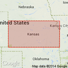
Pg. 158-159. Amazonia limestone member of Lawrence shale of Douglas group. Occurs about 24 feet below top of Lawrence shale at Amazonia, at Heumader quarry, 1.5 miles northwest of St. Joseph, northwestern Missouri, and near Wathena, eastern Kansas. Thickness 9 feet at type locality; 13 feet near St. Joseph and Wathena; thins southward. Age is Late Pennsylvanian (Virgil).
Source: US geologic names lexicon (USGS Bull. 1200, p. 74-75).

- Usage in publication:
-
- Amazonia limestone member*
- Modifications:
-
- Overview
- AAPG geologic province:
-
- Forest City basin
Summary:
Pg. 68 (fig. 24), 72. Amazonia limestone member of Lawrence shale of Douglas group. Typically light-gray dense hard limestone occurring about 15 or 30 feet below top of Lawrence shale. Spearated from underlying Ireland sandstone member by unnamed shale and sandstone interval. Thickness ranges from featheredge to about 13 feet. In southern outcrop area, it averages about 1.5 feet. Age is Late Pennsylvanian (Virgil).
Source: US geologic names lexicon (USGS Bull. 1200, p. 74-75).
For more information, please contact Nancy Stamm, Geologic Names Committee Secretary.
Asterisk (*) indicates published by U.S. Geological Survey authors.
"No current usage" (†) implies that a name has been abandoned or has fallen into disuse. Former usage and, if known, replacement name given in parentheses ( ).
Slash (/) indicates name conflicts with nomenclatural guidelines (CSN, 1933; ACSN, 1961, 1970; NACSN, 1983, 2005, 2021). May be explained within brackets ([ ]).

