The National Geologic Map Database is migrating to a new infrastructure. We apologize for any service disruptions during this process.
|
|---|


- Usage in publication:
-
- Alvord Peak basalt*
- Modifications:
-
- Original reference
- Dominant lithology:
-
- Basalt
- AAPG geologic province:
-
- Mojave basin
Summary:
Pg. 15, 18-21, pls. 1-2. Alvord Peak basalt. Consists of nonporphyritic basalt flow sequence. Thickness 300 to 400 feet at Alvord Peak. Conformably overlies Clews fanglomerate (new); northwestward, overlaps Clews as fanglomerate wedges out, and rests on plutonic rocks and granodiorite porphyry dikes of basement complex. Underlies Spanish Canyon formation (new) or Barstow where Spanish Canyon is missing. Assigned to middle Miocene or older on basis of middle Miocene vertebrate fossils in lower part of overlying Barstow.
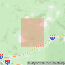
Type section: exposures in west wall of Spanish Canyon, in sec. 6, T. 11 N., R. 4 E., Alvord Mountain quadrangle, San Bernardino Co., southern CA. Named from Alvord Peak, Alvord Mountain quadrangle, San Bernardino Co., southern CA.
Source: US geologic names lexicon (USGS Bull. 1200, p. 71); GNC index card files (USGS-Menlo).
For more information, please contact Nancy Stamm, Geologic Names Committee Secretary.
Asterisk (*) indicates published by U.S. Geological Survey authors.
"No current usage" (†) implies that a name has been abandoned or has fallen into disuse. Former usage and, if known, replacement name given in parentheses ( ).
Slash (/) indicates name conflicts with nomenclatural guidelines (CSN, 1933; ACSN, 1961, 1970; NACSN, 1983, 2005, 2021). May be explained within brackets ([ ]).