The National Geologic Map Database is migrating to a new infrastructure. We apologize for any service disruptions during this process.
|
|---|


- Usage in publication:
-
- Alum Mountain Formation
- Modifications:
-
- Original reference
- Dominant lithology:
-
- Andesite
- Latite
- Breccia
- AAPG geologic province:
-
- Basin-and-Range province
Summary:
Pg. 238, fig. 2. Alum Mountain Formation. Consists of andesite flows and flow breccias succeeded upward by dark-colored latite flows and breccias (p. 274; field trip stop 12, Gila Canyon). Younger than Tadpole Ridge Quartz Latite and older than Bloodgood Canyon Tuff. Age is Oligocene.
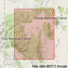
Type locality: Alum Mountain, northeastern Grant Co., southwestern NM. Named from Alum Mountain.
Source: US geologic names lexicon (USGS Bull. 1520, p. 8); supplemental information from GNU records (USGS DDS-6; Denver GNULEX).

- Usage in publication:
-
- volcanic complex of Alum Mountain
- Modifications:
-
- Geochronologic dating
- AAPG geologic province:
-
- Basin-and-Range province
Summary:
Pg. 25-26, geologic time scale (inside front cover). volcanic complex of Alum Mountain. Sample from fine-grained granite dike, in gulch about 0.4 km west of NM Highway 756, in S/2 sec. 17, T. 14 S., R. 13 W., Lat. 33 deg. 04 min. 31 sec. N., Long. 108 deg. 21 min. 26 sec. W., Copperas Peak quadrangle, Grant County, New Mexico, yielded a K-Ar age of 30.4 +/-0.7 Ma. Age 29.7 Ma reported by Ratte and Gaskill (1975); recalculated using decay constants of Steiger and Jager, 1977 (Earth Planet. Sci. Letters, v. 36, p. 359-362). [Oligocene, based on time scale of Berggren, 1972, Lethaia, v. 5, no. 2, p. 195-215.]
Source: Publication.
For more information, please contact Nancy Stamm, Geologic Names Committee Secretary.
Asterisk (*) indicates published by U.S. Geological Survey authors.
"No current usage" (†) implies that a name has been abandoned or has fallen into disuse. Former usage and, if known, replacement name given in parentheses ( ).
Slash (/) indicates name conflicts with nomenclatural guidelines (CSN, 1933; ACSN, 1961, 1970; NACSN, 1983, 2005, 2021). May be explained within brackets ([ ]).