The National Geologic Map Database is migrating to a new infrastructure. We apologize for any service disruptions during this process.
|
|---|


- Usage in publication:
-
- Alturas formation
- Modifications:
-
- Original reference
- Biostratigraphic dating
- Dominant lithology:
-
- Tuff
- Shale
- AAPG geologic province:
-
- Modoc Plateau province
- Great Basin province
Summary:
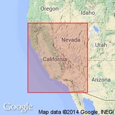
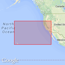
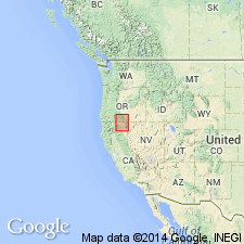
Pg. 6, 23. Alturas formation. A small flora has been collected from Rattlesnake Butte, 4 +/-mi. east of Alturas, Modoc County, northeastern California. The beds, which are here referred to as Alturas formation, consist of gray sandy tuffs and shales containing both plant and vertebrate remains. The mammalian remains collected by Stock appear to indicate [late] Pliocene age. [Age is late Pliocene based on fossils (mammals).]
Source: US geologic names lexicon (USGS Bull. 896, p. 42).
- Usage in publication:
-
- Alturas formation
- Modifications:
-
- Biostratigraphic dating
- AAPG geologic province:
-
- Modoc Plateau province
- Great Basin province
Summary:
USGS Bull. 896: Alturas formation. Upper Cedarville formation (Pliocene) of Modoc County, northeastern California, is overlain by Alturas formation, but at Camp 49, Nevada, the Alturas is absent, and Warner basalt rests on the Upper Cedarville.
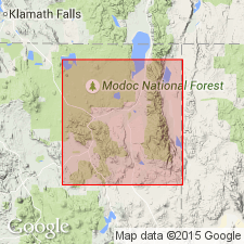
GNU records (USGS DDS-6; Menlo GNULEX): Beds of Pliocene age previously referred to "upper" Cedarville formation [by Russell, 1928] are called Alturas formation which occurs typically on slopes of Rattlesnake Butte, Modoc Co., CA. Overlies weathered surface of Cedarville formation at Rattlesnake Butte, Davis Creek, Tuledad Canyon and Warner valley. Contains Pliocene florule and early to middle Pliocene vertebrate fauna.
Source: US geologic names lexicon (USGS Bull. 896, p. 42); GNU records (USGS DDS-6; Menlo GNULEX).
- Usage in publication:
-
- Alturas formation
- Modifications:
-
- Biostratigraphic dating
- AAPG geologic province:
-
- Modoc Plateau province
- Great Basin province
Summary:
USGS Bull. 1200: Pg. 264, 276 (table 25). Alturas formation. Relatively horizontal strata; includes coarse, brownish tuffaceous sandstones and pebbly conglomerates, as well as lenses of white to gray tuffaceous shales and clays. Total thickness only a few hundred feet. Rests disconformably upon channeled and eroded surface of Upper Cedarville formation; overlain regularly by Warner basalt. Age is Pliocene.
GNU records (USGS DDS-6; Menlo GNULEX): Is exposed along Pit River valley from vicinity of Rattlesnake Butte eastward for 10 mi to Alturas and northward for another 20 mi to Davis Creek. Is 355 ft thick at Rattlesnake Butte. Disconformably overlies Upper Cedarville [series of Russell, 1928]; underlies Warner basalt. List of Alturas flora collected from north bank of Pit River about 0.5 mi southwest of Rattlesnake Butte included in report. Age of Alturas flora is middle Pliocene.
Source: US geologic names lexicon (USGS Bull. 1200, p. 68); GNU records (USGS DDS-6; Menlo GNULEX).
- Usage in publication:
-
- Alturas Formation
- Modifications:
-
- Revised
- Age modified
- AAPG geologic province:
-
- Modoc Plateau province
- Great Basin province
Summary:
Divided into two sedimentary members separated by Pliocene and Pleistocene basalt member and newly named /Warm Springs tuff member of Pliocene and Pleistocene age. Alturas formation consists of moderately consolidated, flat-lying beds of tuff, ashy sandstone, and diatomite deposited in lakes which occupied this area at various times from Miocene to Pleistocene. Total thickness is from 950 to 1450 ft. Age given as Pliocene and Pleistocene.
[/Warm Springs tuff member preempted by Warm Springs Formation of Lupher (1941) in CA.]
Source: GNU records (USGS DDS-6; Menlo GNULEX).
- Usage in publication:
-
- Alturas Formation
- Modifications:
-
- Geochronologic dating
- AAPG geologic province:
-
- Modoc Plateau province
- Great Basin province
Summary:
Radiometric (K-Ar) age of 8.1 Ma on plagioclase from tuff from Alturas Formation was collected from Rattlesnake Butte near Alturas, California. "Sample is from leaf-bearing tuff at base of Alturas Formation. An undescribed collection of fossil mammals of Hemphillian Age has been collected from the Alturas Formation but exact stratigraphic relation to the dated tuff (and thus to the Alturas Flora) is not known."
Source: GNU records (USGS DDS-6; Menlo GNULEX).
- Usage in publication:
-
- Alturas Formation
- Modifications:
-
- Biostratigraphic dating
- AAPG geologic province:
-
- Modoc Plateau province
- Great Basin province
Summary:
"Mammalian fossils from tuffaceous sedimentary rocks of the Alturas Formation of Dorf (1933) beneath the basalt of Devils Garden near Alturas are of early Pliocene (early Blancan) age (Repenning, 1980)." [Note that Blancan is defined as "Pleistocene" in Glossary of Geology, 3rd ed., 1987].
Source: GNU records (USGS DDS-6; Menlo GNULEX).
For more information, please contact Nancy Stamm, Geologic Names Committee Secretary.
Asterisk (*) indicates published by U.S. Geological Survey authors.
"No current usage" (†) implies that a name has been abandoned or has fallen into disuse. Former usage and, if known, replacement name given in parentheses ( ).
Slash (/) indicates name conflicts with nomenclatural guidelines (CSN, 1933; ACSN, 1961, 1970; NACSN, 1983, 2005, 2021). May be explained within brackets ([ ]).