

- Usage in publication:
-
- Alta beds
- Modifications:
-
- Original reference
- Dominant lithology:
-
- Sandstone
- Siltstone
- Claystone
- AAPG geologic province:
-
- Permian basin
Summary:
Pg. 10-25. Alta beds. Upper part yellow sand 1,500 feet thick; lower part dark-colored mixture of silt, clay, and some sand, 2,000 feet thick. Middle formation of Chinati series. Underlies Cibolo limestones and overlies Cieneguita beds. Few fossils. [Age is Permian.]
Named from Sierra Alta Hill, on side of Sierra Alta Creek, Shafter district, Presidio Co., southwestern TX.
Source: US geologic names lexicon (USGS Bull. 896, p. 38).
- Usage in publication:
-
- Alta beds
- Modifications:
-
- Age modified
- AAPG geologic province:
-
- Permian basin
Summary:
Pg. 908. Alta beds. Cieneguita and Alta beds of Shafter region, formerly classed as Pennsylvanian, proved to be of Leonard (Permian) age. [See also C.L. Baker, 1929 (Univ. Texas Bull., no. 2901, p. 73+).]
Source: US geologic names lexicon (USGS Bull. 896, p. 38).

- Usage in publication:
-
- Alta formation*
- Modifications:
-
- Overview
- AAPG geologic province:
-
- Permian basin
Summary:
Pg. 165. Alta formation [name adopted by the USGS]. Sandy and clayey beds with little or no limestones or other calcarous deposits. Lower part chiefly dark shale, 2,000 feet. Upper part lighter colored, more or less sandy, shales, and sandstones of fine texture, 1,550 feet. Apparently conformable with overlying and underlying formations. Fossils from lower shale member (brachiopod PRODUCTUS IVESI and ammonoid PERRINITES VIDRIENSIS) indicate Leonard age.
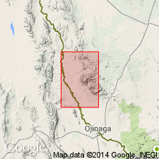
Type locality stated to be about 3 mi north of Cibolo ranch at the east side of Chinati Mountains; thickness 3,550 feet. [See also J.W. Skinner, 1940, Upper Paleozoic section of Chinati Mountains, Presidio Co., TX, AAPG Bull., v. 24, no. 1, p. 182, 184 (fig. 2).]
Source: Publication.
- Usage in publication:
-
- Alta formation
- Modifications:
-
- Areal extent
- AAPG geologic province:
-
- Permian basin
Summary:
Pg. 673, 674, pl. 2 (column 2). Alta formation. Composed largely of clastics. Underlies Cibolo formation; overlies Cienguita formation. [Age is Permian.]
Source: US geologic names lexicon (USGS Bull. 1200, p. 64).
- Usage in publication:
-
- Alta formation
- Modifications:
-
- Revised
- Age modified
- Mapped
- Dominant lithology:
-
- Shale
- Sandstone
- AAPG geologic province:
-
- Permian basin
Summary:
Fig. 3 (facing p. 24), p. 32 (table 1), 40-44, 167 (measured section 4), geol. map. Alta formation. Consists of (descending): fossiliferous limestone, 40 feet; fossiliferous calcareous sandstone, 60 feet; irregularly bedded yellow sandstone, 2,370 feet; black carbonaceous shale, 2,945 feet. Maximum thickness 5,415+/- feet. Underlies Cibolo formation (restricted to beds of Leonard age) and overlies Cieneguita formation of Strawn to Cisco age [Middle to Late Pennsylvanian]. Fossils (notably PARAFUSULINA and SCHWAGERINA) in upper 100 feet. Age is Early Permian (Wolfcamp).
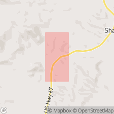
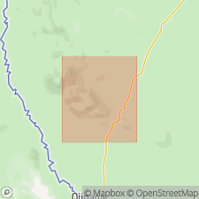
Type section [composite] stated to be about 200 yds due south of White's shipping pens on Cieneguita-Cibolo Ranch Road, about 3 mi west of its junction with US Highway 67, 3.7+ mi N. 34 deg. W. of Shafter triangulation station.
Source: Publication.
- Usage in publication:
-
- Alta formation
- Modifications:
-
- Mapped
- Dominant lithology:
-
- Mudstone
- AAPG geologic province:
-
- Permian basin
Summary:
Alta formation. Oldest formation exposed in Pinto Canyon, Presidio County, southwestern Texas. Dark-gray thin-bedded mudstone forms about 80 percent of the 610 feet exposed in measured section. Underlies Pinto Canyon formation (new). Age is Permian (Wolfcamp?).
Source: Publication; US geologic names lexicon (USGS Bull. 1200, p. 64).
For more information, please contact Nancy Stamm, Geologic Names Committee Secretary.
Asterisk (*) indicates published by U.S. Geological Survey authors.
"No current usage" (†) implies that a name has been abandoned or has fallen into disuse. Former usage and, if known, replacement name given in parentheses ( ).
Slash (/) indicates name conflicts with nomenclatural guidelines (CSN, 1933; ACSN, 1961, 1970; NACSN, 1983, 2005, 2021). May be explained within brackets ([ ]).