

- Usage in publication:
-
- Alloway clay
- Modifications:
-
- Named
- Dominant lithology:
-
- Clay
- AAPG geologic province:
-
- Atlantic Coast basin
Summary:
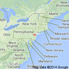
Alloway clay, part of Kirkwood formation, is described as a continuous bed of clay without sand beds of sufficient extent to show in outcrop. Usually light brown, although some parts are white, yellow, and black. Thickness ranges from 0 to 80 ft. Underlies Shiloh marl and overlies a thin bed of micaceous white talc-like clayey sand near Woodstown and towards Ewan Mills. Continuous from near Swans Mill, south of Mullica Hill, Gloucester Co., to a point 2 mi south of Alloway, Salem Co. Isolated outcrops have been seen as far south as Stow Creek Township, Cumberland Co., NJ.
Source: GNU records (USGS DDS-6; Reston GNULEX).
- Usage in publication:
-
- Alloway Clay Member
- Modifications:
-
- Revised
- Overview
- Areal extent
- AAPG geologic province:
-
- Atlantic Coast basin
Summary:
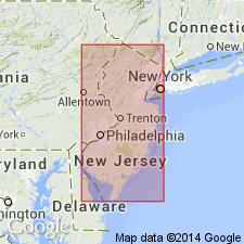
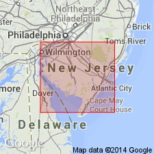
Alloway Clay Member of Kirkwood consists of silty clay and is limited in outcrop to Gloucester, Salem, and Cumberland Cos., southern NJ. At its northern limit it merges with the lower portion of the Grenloch Sand Member and loses its identity. It apparently contains the Shiloh Marl beds and the here informally established "Cohansey quartzite-sandstone lithofacies" (formerly known as the "Cohansey quartzite").
Source: GNU records (USGS DDS-6; Reston GNULEX).
- Usage in publication:
-
- Alloway Clay Member*
- Modifications:
-
- Overview
- AAPG geologic province:
-
- Atlantic Coast basin
Summary:
Alloway clay of Kummel and Knapp (1904) adopted as Alloway Clay Member of Kirkwood Formation as used by Isphording (1970). Unit is basal member of Kirkwood; probably underlies Shiloh Marl Member. Overlies Piney Point aquifer. Occurs Cumberland, Atlantic, Gloucester, and Camden Cos., NJ. Age is middle Miocene.
Source: GNU records (USGS DDS-6; Reston GNULEX).
- Usage in publication:
-
- Alloway Clay Member*
- Modifications:
-
- Revised
- Areal extent
- AAPG geologic province:
-
- Atlantic Coast basin
Summary:
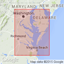
In northeastern MD and central DE, Alloway Clay Member reassigned from Calvert Formation of Chesapeake Group to Kirkwood Formation, here geographically extended from NJ and PA into northeastern MD and central DE.
Source: GNU records (USGS DDS-6; Reston GNULEX).
- Usage in publication:
-
- Alloway Clay Member
- Modifications:
-
- Revised
- Areal extent
- AAPG geologic province:
-
- Atlantic Coast basin
Summary:
Advance copy (1978). Alloway Clay Member of Calvert Formation. Tentatively extended into Maryland and Delaware as a member of Calvert Formation. Overlies Fairhaven Member. Interfingers with Plum Point Marl Member. (Alloway Clay Member of Calvert Formation not adopted by the USGS; see Gibson, 1982, Florida Geol. Survey Spec. Pub., no. 25.)
Source: Modified from GNU records (USGS DDS-6; Reston GNULEX).
For more information, please contact Nancy Stamm, Geologic Names Committee Secretary.
Asterisk (*) indicates published by U.S. Geological Survey authors.
"No current usage" (†) implies that a name has been abandoned or has fallen into disuse. Former usage and, if known, replacement name given in parentheses ( ).
Slash (/) indicates name conflicts with nomenclatural guidelines (CSN, 1933; ACSN, 1961, 1970; NACSN, 1983, 2005, 2021). May be explained within brackets ([ ]).