The National Geologic Map Database is migrating to a new infrastructure. We apologize for any service disruptions during this process.
|
|---|


- Usage in publication:
-
- Allan Mountain Limestone*
- Modifications:
-
- Original reference
- Dominant lithology:
-
- Limestone
- AAPG geologic province:
-
- Montana folded belt
- Sweetgrass arch
Summary:
Pg. 2006-2008, 2009-2014. Allan Mountain Limestone of Madison Group. Lower formation of Madison Group [in Sun River Canyon area, Sawtooth Range, northwestern Montana]. Includes all rocks called MB 2 and MC by Sloss and Laird (1945, USGS Oil and Gas Inv. Prelim. Chart 15). Thickness about 575 feet. Composed of three unnamed members. Lower member, as much as 226 feet thick, comprises lower shaly part of MC unit of Sloss and Laird and is essentially equivalent to Saypo Limestone Member of Deiss (1933, Montana Bur. Mines Mem., no. 6). Middle member about 150 feet, includes medium-bedded cherty limestones formerly included in upper part of unit MC of Sloss and Laird; probably correlative with Dean Lake Chert Member of Deiss (1933). Upper member, 200 to 350 feet, mainly medium- to thick-bedded limestone that is essentially equivalent to unit MB 2 of Sloss and Laird. Underlies Castle Reef Dolomite (new), [upper formation of Madison]. [Conformably overlies Devonian limestone. Contains beds of Kinderhook and Osage age (corals, brachiopods, crinoids, pelecypods). Is approx. the same age as Lodgepole Limestone, Early Mississippian.]
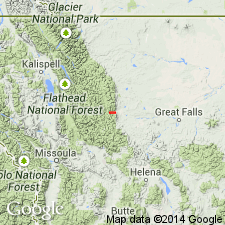
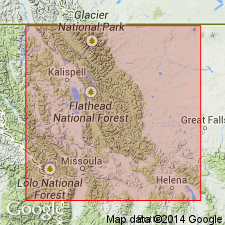
Type section: exposure along north shore of Gibson Reservoir, in SE/4 sec. 36, T. 22 N., R. 10 W., Patricks Basin quadrangle, Teton Co., northwestern MT. Well exposed on Allan Mountain.
Source: US geologic names lexicon (USGS Bull. 1350, p. 15); supplemental information from GNU records (USGS DDS-6; Denver GNULEX).
- Usage in publication:
-
- Allan Mountain Limestone*
- Modifications:
-
- Mapped 1:24k
- Dominant lithology:
-
- Limestone
- AAPG geologic province:
-
- Montana folded belt
- Sweetgrass arch
Summary:
Allan Mountain Limestone. Mapped in Sawtooth Ridge quadrangle, Teton and Lewis and Clark Counties where it is about 575 feet thick and consists of three unnamed members. Underlies Castle Reef Dolomite. Unconformable above Three Forks Formation (Devonian).
Source: US geologic names lexicon (USGS Bull. 1350, p. 15).
- Usage in publication:
-
- Allan Mountain Formation*
- Modifications:
-
- Redescribed
- Revised
- Dominant lithology:
-
- Limestone
- Mudstone
- Chert
- AAPG geologic province:
-
- Montana folded belt
- Sweetgrass arch
Summary:
Named changed in the Sweetgrass arch and Montana folded belt province from Allan Mountain Limestone to Allan Mountain Formation, basal formation of Mississippian Madison Group, because it is a dark-gray, thin- to thick-bedded, interbedded bioclastic lime wackestone, mudstone, and packstone containing abundant nodules and lentils of brown-gray chert. Has abundant fenestrate bryozoans, coral, and brachiopod fossils. Upper contact raised 166 m to include a dolomitized crinoidal grainstone formerly mapped as part of lower member of Castle Reef Dolomite (changed to Castle Reef Formation in this report). The basal 2.1 ft thick unit of the 116 m unit is a bed of secondary dolomite that can be recognized throughout the Sawtooth Range. This 116 m unit part of unit 23 (Mudge, 1972, p. A94). As redefined, Allan Mountain is a low-energy deposit, a contrast to the overlying Castle Reef, a high-energy deposit.
Source: GNU records (USGS DDS-6; Denver GNULEX).
For more information, please contact Nancy Stamm, Geologic Names Committee Secretary.
Asterisk (*) indicates published by U.S. Geological Survey authors.
"No current usage" (†) implies that a name has been abandoned or has fallen into disuse. Former usage and, if known, replacement name given in parentheses ( ).
Slash (/) indicates name conflicts with nomenclatural guidelines (CSN, 1933; ACSN, 1961, 1970; NACSN, 1983, 2005, 2021). May be explained within brackets ([ ]).