- Usage in publication:
-
- Allamoore limestone*
- Modifications:
-
- Original reference
- Dominant lithology:
-
- Limestone
- Chert
- Volcanics
- AAPG geologic province:
-
- Southwestern Basin-and-Range region
Summary:
Pg. 144 (fig. 1), 145, 148-149. Allamoore limestone. Name proposed for lower part of †Millican formation of Richardson (here abandoned). Limestone is characteristically thin-bedded, of blue, gray, or brown color, with nearly all beds seamed at regular intervals by thin bands of chert. Associated with limestone are masses of volcanic rocks; these include diabase flows, in part amygdaloidal, in part massive, and various pyroclastic rocks, such as breccias and fine-grained, well-bedded tuffs. Volcanics are interbedded with limestone in thin to thick members. Allamoore is exposed only in strongly folded belt north of overthrust mass of Carrizo Mountain schist. Over wide areas its beds stand nearly vertical, so that its thickness is perhaps to be measured in thousands of feet. Underlies Hazel sandstone (reinstated); overlies Carrizo Mountain schist. Few indications of fossils, but certain features in limestones may be of algal origin. Age is Precambrian. Report includes stratigraphic chart, regional sketch map.
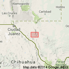
Type area: Van Horn region, Culberson and Hudspeth Cos., TX. Named from village of Allamoore, 11 mi west of Van Horn on the Texas and Pacific RR and U.S. Highway 80. This name is spelled two ways, Allamoore for the post office, Allamore for the railroad station. Post office spelling is one adopted.
Source: US geologic names lexicon (USGS Bull. 1200, p. 52); supplemental information from GNU records (USGS DDS-6; Denver GNULEX).

- Usage in publication:
-
- [Allamoore limestone]
- Modifications:
-
- Overview
- AAPG geologic province:
-
- Southwestern Basin-and-Range region
Summary:
Pg. 1. [Allamoore limestone]. Thickness given as 3,000 feet.
Source: US geologic names lexicon (USGS Bull. 1200, p. 52).
For more information, please contact Nancy Stamm, Geologic Names Committee Secretary.
Asterisk (*) indicates published by U.S. Geological Survey authors.
"No current usage" (†) implies that a name has been abandoned or has fallen into disuse. Former usage and, if known, replacement name given in parentheses ( ).
Slash (/) indicates name conflicts with nomenclatural guidelines (CSN, 1933; ACSN, 1961, 1970; NACSN, 1983, 2005, 2021). May be explained within brackets ([ ]).

