The National Geologic Map Database is migrating to a new infrastructure. We apologize for any service disruptions during this process.
|
|---|


- Usage in publication:
-
- Alisitos formation
- Modifications:
-
- Named
- Dominant lithology:
-
- Slate
- AAPG geologic province:
-
- Peninsular Ranges province
Summary:
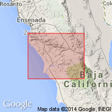
Named for slates and metamorphosed sandstone near Alisitos Ranch, Santo Tomas R., Baja California, Mexico. Is from 5 cm to 200 m thick. Assigned Early Cretaceous age on basis of fossils identified by B.L. Clark, Univ. of California.
Source: GNU records (USGS DDS-6; Menlo GNULEX).
- Usage in publication:
-
- Alisitos formation
- Modifications:
-
- Age modified
- AAPG geologic province:
-
- Peninsular Ranges province
Summary:
Consists of upper member of biohermal limestones and lower member of fine sediments in Punta China section. Upper member is middle Albian age on basis of Gastropoda and Foraminifera. Lower member is Aptian(?) age based on environment and fossils.
Source: GNU records (USGS DDS-6; Menlo GNULEX).
- Usage in publication:
-
- Alisitos Formation
- Modifications:
-
- Areal extent
- AAPG geologic province:
-
- Peninsular Ranges province
Summary:
"Certain rocks in western San Diego [County], previously ascribed to 'Julian Schist' are actually Alisitos Formation."
Source: GNU records (USGS DDS-6; Menlo GNULEX).
- Usage in publication:
-
- Alisitos Formation
- Modifications:
-
- Areal extent
- AAPG geologic province:
-
- Peninsular Ranges province
Summary:
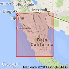
Name Alisitos formation (Santillan and Barrera, 1930) is used for Santiago Peak volcanics (Larsen, 1948) and San Fernando formation (Anon, 1924; Beal, 1948). Consists of 3 unnamed members. Is about 5000 ft thick. Unconformably overlies Bedford formation in California and San Telmo formation in Baja California, Mexico. Unconformably underlies Rosario formation in Baja California. Assigned Early Cretaceous age.
Source: GNU records (USGS DDS-6; Menlo GNULEX).
- Usage in publication:
-
- Alisitos Formation
- Modifications:
-
- Areal extent
- AAPG geologic province:
-
- Peninsular Ranges province
Summary:
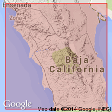
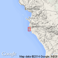
Name "Alisitos Formation" applied to rocks of Ensenada-Colonia Guerrero area. See Fig.1
Source: GNU records (USGS DDS-6; Menlo GNULEX).
- Usage in publication:
-
- Alisitos Formation
- Modifications:
-
- Areal extent
- AAPG geologic province:
-
- Peninsular Ranges province
Summary:
Should include rocks of San Fernando Formation (type locality near Dominican Mission, San Fernando, 325 km south of northern boundary of Baja California), based on distinctive lithologies and paleontological similarities.
Source: GNU records (USGS DDS-6; Menlo GNULEX).
- Usage in publication:
-
- Alisitos Formation
- Modifications:
-
- Areal extent
- AAPG geologic province:
-
- Peninsular Ranges province
Summary:
Name "Alisitos Formation" not justified for Santiago Peak Volcanics (as if it were a northern extension) because age differences exist between the two formations.
Source: GNU records (USGS DDS-6; Menlo GNULEX).
- Usage in publication:
-
- Alisitos Formation
- Modifications:
-
- Overview
- AAPG geologic province:
-
- Peninsular Ranges province
Summary:
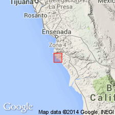
Mapped [as of 1964] in type area from Punta China and Los Muertos on the coast to the valley of Santo Tomas River. Is 7500 m thick.
Source: GNU records (USGS DDS-6; Menlo GNULEX).
- Usage in publication:
-
- Alisitos Group
- Modifications:
-
- Revised
- AAPG geologic province:
-
- Peninsular Ranges province
Summary:
Called "Alisitos Group". Divided into 7 facies: A. welded tuff, B. large-volume pumiceous tuff-breccia, C. small-volume lithic-vitric tuff-breccia, D. "double-graded" sequences, E. pyroclastic fallout tuff, F. hydroclastic agglomerate-breccia, and G. lahar breccia. [Name "Alisitos Group" not appropriate because "named" formations are not designated within group]
Source: GNU records (USGS DDS-6; Menlo GNULEX).
For more information, please contact Nancy Stamm, Geologic Names Committee Secretary.
Asterisk (*) indicates published by U.S. Geological Survey authors.
"No current usage" (†) implies that a name has been abandoned or has fallen into disuse. Former usage and, if known, replacement name given in parentheses ( ).
Slash (/) indicates name conflicts with nomenclatural guidelines (CSN, 1933; ACSN, 1961, 1970; NACSN, 1983, 2005, 2021). May be explained within brackets ([ ]).