- Usage in publication:
-
- Alhambra formation
- Modifications:
-
- Original reference
- Dominant lithology:
-
- Shale
- Sandstone
- AAPG geologic province:
-
- Sacramento basin
Summary:
Pg. 19 (chart), 49, 50-53, pls. 2B, 4A. Alhambra formation. Proposed for a sequence of brown silty shale, coarse silty sandstone and thinly laminated light-gray to white brittle shale which unconformably underlies San Ramon formation and overlies Escobar sandstone (new) in both limbs of Pacheco syncline. Thickness about 834 feet. In area of type section, comprises (ascending) Castro shale, Roop sandstone, and Pereira shale members (all new). Alhambra was mapped as Tejon in Concord quadrangle of San Francisco folio. Age is late Eocene.
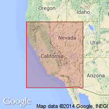
Type section: west limb of Pacheco syncline in Santa Fe cuts east of east portal of Muir Tunnel near Martinez, Contra Costa Co., west-central CA.
Source: US geologic names lexicon (USGS Bull. 1200, p. 50).
For more information, please contact Nancy Stamm, Geologic Names Committee Secretary.
Asterisk (*) indicates published by U.S. Geological Survey authors.
"No current usage" (†) implies that a name has been abandoned or has fallen into disuse. Former usage and, if known, replacement name given in parentheses ( ).
Slash (/) indicates name conflicts with nomenclatural guidelines (CSN, 1933; ACSN, 1961, 1970; NACSN, 1983, 2005, 2021). May be explained within brackets ([ ]).

