The National Geologic Map Database is migrating to a new infrastructure. We apologize for any service disruptions during this process.
|
|---|


- Usage in publication:
-
- Alegria formation
- Modifications:
-
- Original reference
- Dominant lithology:
-
- Sandstone
- AAPG geologic province:
-
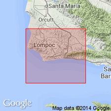
- Santa Maria basin
Summary:
Pg. 30-31, pls. 1, 2. Alegria formation. Defined as marine facies of continental Sespe formation in Gaviota and Point Conception quadrangles. Consists of about 1,200 feet of sandstone and minor amount of siltstone lying conformably above Gaviota formation and disconformably below Vaqueros formation. Varies in lithology and thickness along strike. From Agua Caliente Canyon grades laterally eastward into nonmarine Sespe; red clays appear progressively lower until at Capitan Canyon they occur throughout section, which apparently is all nonmarine. Age is Oligocene (Refugian).
Type locality: ridge east of Canada de Santa Anita, Santa Barbara Co., south-central CA. Formation is developed only on south flank of Santa Ynez Range between a point 4 mi north of Point Conception and Capitan Canyon.
Source: US geologic names lexicon (USGS Bull. 1200, p. 47-48).
For more information, please contact Nancy Stamm, Geologic Names Committee Secretary.
Asterisk (*) indicates published by U.S. Geological Survey authors.
"No current usage" (†) implies that a name has been abandoned or has fallen into disuse. Former usage and, if known, replacement name given in parentheses ( ).
Slash (/) indicates name conflicts with nomenclatural guidelines (CSN, 1933; ACSN, 1961, 1970; NACSN, 1983, 2005, 2021). May be explained within brackets ([ ]).