The National Geologic Map Database is migrating to a new infrastructure. We apologize for any service disruptions during this process.
|
|---|


- Usage in publication:
-
- Aldwell formation*
- Modifications:
-
- Original reference
- Dominant lithology:
-
- Siltstone
- AAPG geologic province:
-
- Puget Sound province
Summary:
Aldwell formation. Named for a sequence of well-indurated greenish-gray to medium-olive-gray marine siltstone that overlies and interfingers with Crescent formation in south limb of Clallam syncline. At type locality, lentil of pillow lava and flow breccia about 350 feet thick occurs 1,000 feet above base of formation; similar lentils or tongues of lava present in formation in other parts of area. Thickness about 2,950 feet at type locality; less than 100 feet near western boundary of mapped area. Underlies and interfingers with Lyre formation. Foraminifera, together with stratigraphic position, establish age of formation as middle to early late Eocene. Therefore correlates with McIntosh formation of southwestern Washington and Yamhill formation of western Oregon.
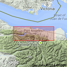
Type section: exposures along Lake Aldwell, on Elwha River from point 700 ft west, 50 ft south of northeast corner of sec. 28, T. 30 N., R. 7 W., to point 1,600 ft east, 1,200 ft south of northwest corner of sec. 22, T. 30 N., R. 7 W., [in vicinity of Lat. 48 deg. 04 min. 30 sec. N., Long. 123 deg. 34 min. 10 sec. W., Elwha 7.5-min quadrangle], Clallam Co., northwestern WA. Origin of name not stated by authors, but probably named from Lake Aldwell.
Source: Publication; US geologic names lexicon (USGS Bull. 1200, p. 47).
- Usage in publication:
-
- Aldwell formation*
- Modifications:
-
- Areal extent
- AAPG geologic province:
-
- Puget Sound province
Summary:
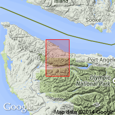
Unit is mapped in Pysht 15' quad, Clallam Co., WA where it thins westward, wedging out near Deep Creek Guard Station. Farther west (north of Deadman Hill) a siltstone unit (on basis of lithology and stratigraphic position) is assigned to the Aldwell formation. This unit is 800 ft thick near Beaver Lake. No fossils found in unit in Pysht quad. Overlies the Crescent formation and underlies and interfingers with the Lyre formation. Correlated in part with the McIntosh formation of southwestern WA. Assigned Eocene age.
Source: GNU records (USGS DDS-6; Menlo GNULEX).
- Usage in publication:
-
- Aldwell Formation*
- Modifications:
-
- Areal extent
- Revised
- AAPG geologic province:
-
- Puget Sound province
Summary:
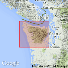
Unit is mapped in northern part of the Olympia Peninsula, WA. Volcanic rocks are shown separately. Is predominantly dark marine mudstone and siltstone with minor amounts of dark, fine-grained sandstone, conglomerate, and lenses of pillow basalt, basalt breccia, and lapilli tuff. Overlies and locally intertongues with the Crescent Formation on the northern part of the peninsula. In Mt. Zion area along the northern side the Aldwell is missing. The Aldwell Formation includes part if not all of fine-grained clastic rocks referred to as Boundary "Argillite" or Shale by earlier workers (Weaver, 1937, p. 124; Loney, 1951, p. 19; Drugg, 1958, p. 28-29; Bagley, 1959, p. 21-22; Lindquist, 1961, p. 23-26; Hamlin, 1962, p. 24-26; Strain, 1964, p. 21-22). Age is middle and early late Eocene (upper Ulatsian and lower Narizian (Rau, 1964, p. G4) based of fossils [foraminifers].
Source: GNU records (USGS DDS-6; Menlo GNULEX).
- Usage in publication:
-
- Aldwell Formation*
- Modifications:
-
- Age modified
- AAPG geologic province:
-
- Puget Sound province
Summary:
Unit is mapped in the Cape Flattery area where it unconformably overlies the Crescent Formation or an unnamed siltstone unit; conformably underlies the Lyre Formation. Consists of graded, thin- and irregular-bedded phyllitic and basaltic sandstone and siltstone. Where rests on siltstone unit 3-m thick quartzo-feldspathic sandstone bed occurs near base. Where overlies the Crescent Formation, the basal part consists of as much as 100 m of massive basaltic sandstone, basalt-pebble conglomerate and mud flow breccia. Age is early late Eocene (lower Narizian age) to late Eocene (upper Narizian age) in the Cape Flattery and Lake Sutherland areas based on fossils [foraminifers] (W.W. Rau, written commun., 1974).
Source: GNU records (USGS DDS-6; Menlo GNULEX).
For more information, please contact Nancy Stamm, Geologic Names Committee Secretary.
Asterisk (*) indicates published by U.S. Geological Survey authors.
"No current usage" (†) implies that a name has been abandoned or has fallen into disuse. Former usage and, if known, replacement name given in parentheses ( ).
Slash (/) indicates name conflicts with nomenclatural guidelines (CSN, 1933; ACSN, 1961, 1970; NACSN, 1983, 2005, 2021). May be explained within brackets ([ ]).