- Usage in publication:
-
- Aldrich Station formation
- Modifications:
-
- Original reference
- AAPG geologic province:
-
- Great Basin province
Summary:
Pg. 23-29, 63-64, figs. 2, 3, 4. Aldrich Station formation. Consists of six major lithologic units (ascending): (1) sandstone, shale, conglomerate, and breccia, thickness 150 feet; (2) siliceous shale, thickness 400 feet; (3) sandstone and conglomerate, thickness 750 feet; (4) siliceous shale, thickness 350 feet; (5) diatomaceous shale, thickness 1,600 feet; and (6) silt, sandstone, and pebble conglomerate, thickness 800 feet. Aggregate thickness 4,050 feet. Underlies Coal Valley formation with local unconformity; overlies older rocks with unconformity. [Age is Miocene (late Barstovian) to Pliocene (early Clarendonian); ca. 1995, current age is late Miocene only.]
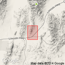
Type area named from Aldrich Station, an old stagecoach station which is now represented by a stone foundation on county road at north base of Aldrich Hill; this site lies near middle of formation. Crops out prominently near base of ·Wassuk Range 5 mi southeast of Morgan's Ranch, where lower part forms conspicuous white knolls against base of the range, Hawthorne quadrangle, western NV.
Unit is named the Aldrich Station formation.
Source: US geologic names lexicon (USGS Bull. 1200, p. 47); supplemental information from GNU records (USGS DDS-6; Menlo GNULEX).
For more information, please contact Nancy Stamm, Geologic Names Committee Secretary.
Asterisk (*) indicates published by U.S. Geological Survey authors.
"No current usage" (†) implies that a name has been abandoned or has fallen into disuse. Former usage and, if known, replacement name given in parentheses ( ).
Slash (/) indicates name conflicts with nomenclatural guidelines (CSN, 1933; ACSN, 1961, 1970; NACSN, 1983, 2005, 2021). May be explained within brackets ([ ]).

