

- Usage in publication:
-
- Alder sedimentary series
- Modifications:
-
- Original reference
- AAPG geologic province:
-
- Southwestern Basin-and-Range region
Summary:
Pg. 1118 (table 1), 1121-1123. Alder sedimentary series. Yavapai group is subdivided into Yaeger greenstone, Red Rock rhyolite, and Adler [Alder] sedimentary series (all new). Series consists of locally metamorphosed shale, grit, quartzite, and conglomerate; intensely folded and faulted. Exposed thickness unknown; appears to exceed 5,000 feet. All observed contacts with Yaeger greenstone (probably oldest in group) and Red Rock rhyolite are faults; hence relative age not definitely known, but character of rhyolite pebbles in its conglomerate suggests that Alder is younger than Red Rock.
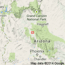
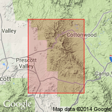
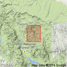
Named from typical exposures in vicinity of Alder Creek, in central segment of Mazatzal Range, Jerome area, AZ. Crops out extensively in Mazatzal Mountains, eastern Tonto basin, Black Hills, and to small extent in Del Rio area. [Misprint? in USGS Bull. 1200: according to GNC index card files, typical exposures not considered to be in Jerome area.]
Source: US geologic names lexicon (USGS Bull. 1200, p. 45-46).
- Usage in publication:
-
- Alder group*
- Modifications:
-
- Revised
- Adopted
- Areal extent
- AAPG geologic province:
-
- Southwestern Basin-and-Range region
Summary:
Pg. 9, 20-32, pl. 1. Alder group. Wilson's Alder series modified to Alder group and adopted by the USGS as the upper group of Yavapai series in Jerome area, Arizona. Divided into six formations, which fall into two classes: those of probable known stratigraphic succession and those of unknown stratigraphic succession. Former comprises three volcanic sequences (ascending): Indian Hills volcanics, Spud Mountain volcanics, and Iron King volcanics (all new); latter divided into Green Gulch volcanics, Chaparral volcanics, and Texas Gulch formation (all new). Thickness not known; appears to be 20,000 feet or more, and may be as much as 30,000 feet thick. Rocks are foliated. Texture and mineralogic assemblages typical of regionally metamorphosed rocks of greenschist facies. Separated from Ash Creek group (new) by Shylock fault; hence relative ages not certain. Is older Precambrian. Report includes geologic map.
Source: US geologic names lexicon (USGS Bull. 1200, p. 45-46); supplemental information (in brackets) from GNU records (USGS DDS-6; Denver GNULEX).
- Usage in publication:
-
- Alder formation
- Modifications:
-
- Revised
- AAPG geologic province:
-
- Southwestern Basin-and-Range region
Summary:
Pg. 1498 (tables 1 and 2), 1499-1500, pl. 1. Alder formation. Referred to as formation. Divided into three unnamed members (ascending): interbedded slate, wacke, quartzite, and conglomerate, thickness unknown, probably 4,000 feet or more; quartzite, 300 to 1,000 feet; slate, wacke, and conglomerate as much as 580 feet. In Diamond Butte quadrangle (this paper), conformably underlies Flying W formation (new); in fault contact with pre-Alder(?) rocks. Upper contact of formation, as here defined, is base of lowest cobble volcanic or volcanic strata. Wilson's Alder series includes up to 1,000 feet of cobble conglomerate. This portion of Alder series may be equivalent to part of Flying W formation. Correlation chart shows Wilson's Alder series stratigraphically above Yaeger greenstone and Red Rock rhyolite.
See also, Gordon Gastil, 1954 [abs.], Older Precambrian stratigraphy of upper Tonto basin, central Arizona, Geological Society of America Bulletin, v. 65, no. 12, pt. 2, p. 1225 [1255-1256?]; Gordon Gastil, 1954, The geology of the eastern half of the Diamond Butte quadrangle, Gila County, Arizona, Univ. of California, Berkeley thesis, 158 p.
Source: US geologic names lexicon (USGS Bull. 1200, p. 45-46).
- Usage in publication:
-
- Alder Group
- Modifications:
-
- Not used
- AAPG geologic province:
-
- Southwestern Basin-and-Range region
Summary:
Pg. C6 (fig. 2), C7 (fig. 3), C14-C15. Alder Group. Restricted to Mazatzal Mountains, its type locality, and removed from Yavapai Series. In the Jerome-Prescott area, Yavapai County, Arizona, Big Bug Group (new) replaces Alder Group. Wilson (1939, p. 1121 and 1158) applied term Alder series to the northern exposures of Precambrian volcanic and sedimentary rocks in the Jerome-Prescott area, west of Shylock fault (fig. 2), because of their lithologic similarity to his type Alder series in the Mazatzal Mountains about 60 miles southeast of the Mingus Mountain quadrangle (fig. 1). Big Bug Group includes (ascending) Green Gulch Volcanics, Spud Mountain Volcanics, and Iron King Volcanics; all formerly considered part of Alder Group. Big Bug Group underlies Texas Gulch Formation (revised). Isotopic data and the field relations indicate that the Texas Gulch Formation, formerly considered oldest formation of Alder Group (citing C.A. Anderson, 1968, GSA Memoir 116, p. 14), in this area must be younger than the Big Bug Group.
Source: Publication; Changes in stratigraphic nomenclature, 1971 (USGS Bull. 1372-A, p. A2-A3).
For more information, please contact Nancy Stamm, Geologic Names Committee Secretary.
Asterisk (*) indicates published by U.S. Geological Survey authors.
"No current usage" (†) implies that a name has been abandoned or has fallen into disuse. Former usage and, if known, replacement name given in parentheses ( ).
Slash (/) indicates name conflicts with nomenclatural guidelines (CSN, 1933; ACSN, 1961, 1970; NACSN, 1983, 2005, 2021). May be explained within brackets ([ ]).