

- Usage in publication:
-
- Albright limestone
- Modifications:
-
- Original reference
- Dominant lithology:
-
- Limestone
- AAPG geologic province:
-
- Appalachian basin
Summary:
Pg. 140. Albright limestone. Dark gray limestone 2 feet thick. Underlies Bakerstown (Barton[?]) coal and rests on 5 to 20 feet of fire clay shale that overlies Pine Creek limestone. [Age is Pennyslvanian.]
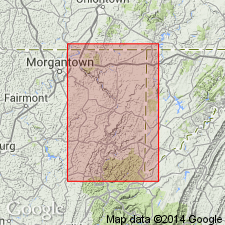
Occurs at Albright, Preston Co., northeastern WV.
Source: US geologic names lexicon (USGS Bull. 896, p. 27).

- Usage in publication:
-
- Albright limestone
- Modifications:
-
- Overview
- AAPG geologic province:
-
- Appalachian basin
Summary:
Albright limestone (in Conemaugh formation). Recognized in northeastern West Virginia and western Maryland. Age is Pennsylvanian.
Maryland Geol. Survey (C.K. Swartz, v. 11, 1922) applied Albright limestone in Maryland to a younger limestone, underlying the fire clay beneath "Upper Bakerstown (Maynardier) coal," and lying a short distance above "Lower Bakerstown (Thomas) coal."
[See also "Tentative correlation of the named geologic units of Maryland," compiled by M.G. Wilmarth, Secretary of Committee on Geologic Names, USGS unpub. corr. chart, Apr. 1, 1929, sheet 1 of 2 (Pennsylvanian-Quaternary).]
Source: US geologic names lexicon (USGS Bull. 896, p. 27); GNC MD Corr. Chart, sheet 1, Apr. 1, 1929.
- Usage in publication:
-
- Albright limestone
- Modifications:
-
- Areal extent
- AAPG geologic province:
-
- Appalachian basin
Summary:
Pg. 120. Bloomfield limestone member of the Conemaugh was named by Stout (1918) in Muskingum County, Ohio. According to Waage (1950, Maryland Dept. Geol. Mines Water Res. Bull., no. 9), Hennen and Reger (1914) named an equivalent limestone in Preston County, West Virginia, the Albright. Thus, Albright has precedence over Bloomfield. Recommended that term Albright replace term Bloomfield if and when positive correlation is determined. Age is Pennsylvanian.
Source: US geologic names lexicon (USGS Bull. 1200, p. 43).
For more information, please contact Nancy Stamm, Geologic Names Committee Secretary.
Asterisk (*) indicates published by U.S. Geological Survey authors.
"No current usage" (†) implies that a name has been abandoned or has fallen into disuse. Former usage and, if known, replacement name given in parentheses ( ).
Slash (/) indicates name conflicts with nomenclatural guidelines (CSN, 1933; ACSN, 1961, 1970; NACSN, 1983, 2005, 2021). May be explained within brackets ([ ]).