The National Geologic Map Database is migrating to a new infrastructure. We apologize for any service disruptions during this process.
|
|---|


- Usage in publication:
-
- Albino Member
- Modifications:
-
- First used
- Dominant lithology:
-
- Tuff
- Bentonite
- Mudstone
- Siltstone
- Sandstone
- AAPG geologic province:
-
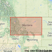
- Montana folded belt
Summary:
First published use as the basal member of the Mowry Shale (or Formation). Was used "informally" in two theses as--"Albino Formation" (Hall, 1961) and "Albino Member of Mowry Formation" (Wilson, 1970). Type section was designated by Hall on southeast side of Lincoln Mountain, NE1/4 sec 7, T9S, R4E, Gallatin Valley, Gallatin Co, MT in the Montana folded belt province. Is 80 m thick at type. Is present to west in the Gravelly Range where it is 10 to 30 m thicker than at type and in the Ruby Mountains. Areal extent map. Consists of tuff, porcellanite, and bentonite interbedded with mudstone, siltstone, and minor tuffaceous sandstone. Individual beds are pink, gray, brown, and green. Is massive and homogeneous in texture. Thought to have been deposited in a delta plain marsh or swamp. Overlies distributary and fluvial deposits of the Albian Muddy Sandstone. Underlies upper unnamed part of Mowry Shale. Stratigraphic chart. Eight fossil fern flora found; 7 new species described--GLEICHENIACEAPHYLLUM FALCATUM, CONIOPTERIS VINYARDII, CLADOPHLEBIS GALLATINENSIS, SHENOPTERIS RACEMOSA, S. TENUIPHYLLA, S. MONTANENSIS, S. FLABELLATA; all collections were made at Lincoln Mountain and along Meadow Creek, NW1/4 sec 6, T9S, R4E. Two species of Schizaeaceous spores identified. Of Albian, Early Cretaceous age.
Source: GNU records (USGS DDS-6; Denver GNULEX).
For more information, please contact Nancy Stamm, Geologic Names Committee Secretary.
Asterisk (*) indicates published by U.S. Geological Survey authors.
"No current usage" (†) implies that a name has been abandoned or has fallen into disuse. Former usage and, if known, replacement name given in parentheses ( ).
Slash (/) indicates name conflicts with nomenclatural guidelines (CSN, 1933; ACSN, 1961, 1970; NACSN, 1983, 2005, 2021). May be explained within brackets ([ ]).