

- Usage in publication:
-
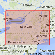
- Albany clay
- Modifications:
-
- Original reference
- Dominant lithology:
-
- Clay
- AAPG geologic province:
-
- New England province
Summary:
Pg. 202-204. Albany clay. Described at Albany, New York. This Tertiary clay is an important material for making brick, and is 10 to 20 feet thick. In excavations at Albany a boulder is sometimes found in the clay, but always near top. [He also described Lake Champlain clays, and stated that the Tertiary of the valley of Hudson is continuous with that in the valley or basin of the Champlain, and does not differ essentially from it.]
Source: US geologic names lexicon (USGS Bull. 896, p. 23); supplemental information from GNU records (USGS DDS-6; Reston GNULEX).
- Usage in publication:
-
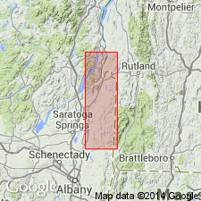
- Albany clay formation
- Modifications:
-
- Areal extent
- AAPG geologic province:
-
- New England province
Summary:
Pg. 872-878, 890-891. Albany clay formation. This is the gray and blue clay of the Quaternary Division of Professor Mather, the Tertiary clay or Albany and Champlain clays of Dr. Emmons, in the volumes of the State Natural History. As neither its geological age or name is well settled, [author] prefers designating it Albany clay, a name by which more readers will obtain a definite idea respecting it than by any other. Is well developed at Albany, from thence it reaches northward, forming bluffs or river hills upon both sides of the Hudson, and continuously to Fort Ann, if not to Whitehall, and onward through whole length of Champlain Valley, particularly upon its Vermont side. Throughout most of its extent it rests on Hudson River slate, though in places extensive beds of gravel, 30 feet thick, intervene between it and the slate. Is overlain by Saratoga sand formation. Is of blue, brown, gray, and white colors, and 6 to 150 feet thick.
Source: US geologic names lexicon (USGS Bull. 896, p. 23).

- Usage in publication:
-
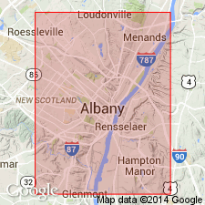
- Albany clays
- Modifications:
-
- Areal extent
- AAPG geologic province:
-
- New England province
Summary:
Pg. 611. Albany clays overlie the boulder clay in vicinity of Albany, New York, and both belong to second ice invasion of glacial period. Age is Pleistocene.
Source: US geologic names lexicon (USGS Bull. 896, p. 23).
- Usage in publication:
-
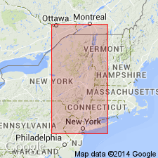
- Albany clays
- Modifications:
-
- Age modified
- AAPG geologic province:
-
- New England province
Summary:
Pg. r12. Albany clays. The so-called Albany clays are somewhat earlier in age than the typical marine clays of Champlain Valley.
Source: US geologic names lexicon (USGS Bull. 896, p. 23).
- Usage in publication:
-
- Albany clays
- Modifications:
-
- Revised
- AAPG geologic province:
-
- New England province
Summary:
Pg. 220. The term "Albany clays" was specifically applied to the glacial rock flours of Hudson Valley north and south of Albany in 1846. Included in Hochelagan formation.
Source: US geologic names lexicon (USGS Bull. 896, p. 23).
- Usage in publication:
-
- Albany clay
- Modifications:
-
- Areal extent
- AAPG geologic province:
-
- New England province
Summary:
Pg. 196 (fig. 72). Albany clay. Varved clays in part of Cats Kill delta in Lake Albany. Age is Pleistocene.
Source: US geologic names lexicon (USGS Bull. 1200, p. 38).
For more information, please contact Nancy Stamm, Geologic Names Committee Secretary.
Asterisk (*) indicates published by U.S. Geological Survey authors.
"No current usage" (†) implies that a name has been abandoned or has fallen into disuse. Former usage and, if known, replacement name given in parentheses ( ).
Slash (/) indicates name conflicts with nomenclatural guidelines (CSN, 1933; ACSN, 1961, 1970; NACSN, 1983, 2005, 2021). May be explained within brackets ([ ]).