

- Usage in publication:
-
- Alamosa formation*
- Modifications:
-
- Original reference
- Dominant lithology:
-
- Sand
- Clay
- Gravel
- AAPG geologic province:
-
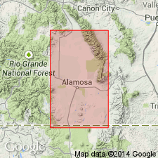
- San Luis basin
Siebenthal, C.E., 1910, The San Luis Valley, Colorado: Science, new series, v. 31, p. 744-746.
Summary:
Pg. 745; USGS Water Supply Paper 240, p. 40. Alamosa formation. Blue clays and interstratified sands; some gravel, and occassionally, in depth boulders. Thickness 725 to 1,250 feet. Of late Pliocene or early Pleistocene (pre-glacial) age. Unconformably overlies Santa Fe formation. Occurs at foot of Conejos Range, at foot of Blanca Peak, and at other places. Occupies bottom of San Luis Valley proper. Named from Alamosa, Conejos Co., near center of valley.
Source: US geologic names lexicon (USGS Bull. 896, p. 22).
- Usage in publication:
-
- Alamosa formation*
- Modifications:
-
- Revised
- AAPG geologic province:
-
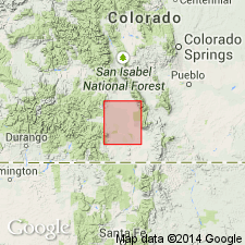
- San Luis basin
Summary:
Pg. 20-24. Alamosa formation. Underlies large part of San Luis Valley but is well exposed only in southern part, where Rio Grande and its tributaries have cut into upper part of formation. Thickness 41.5 feet at Hansen Bluff on east bank of Rio Grande southeast of Alamosa. Recent deposits overlie Alamosa, but similarity of materials make it difficult to determine contact between the two; in this report, Recent materials are included in Alamosa except in some well logs. Most reliable data on formation comes from well logs. [Age is late Pliocene or early Pleistocene, and locally, Recent.]
Source: US geologic names lexicon (USGS Bull. 1200, p. 37).
For more information, please contact Nancy Stamm, Geologic Names Committee Secretary.
Asterisk (*) indicates published by U.S. Geological Survey authors.
"No current usage" (†) implies that a name has been abandoned or has fallen into disuse. Former usage and, if known, replacement name given in parentheses ( ).
Slash (/) indicates name conflicts with nomenclatural guidelines (CSN, 1933; ACSN, 1961, 1970; NACSN, 1983, 2005, 2021). May be explained within brackets ([ ]).