

- Usage in publication:
-
- Alamo formation
- Modifications:
-
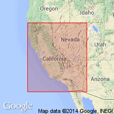
- Areal extent
- AAPG geologic province:
-
- Sacramento basin
Summary:
Pg. 224, 228. Tentatively called Alamo formation. Overlies with slight unconformity Neroly formation. Underlies Orinda formation. Contains abundant poorly preserved leaf impressions of typical San Pablo species. Age is Pliocene. [Mentioned in abstract by Huey, 1937 (GSA Proc. 1936, p. 335) where correlated with shaly facies of upper part of Neroly formation.]
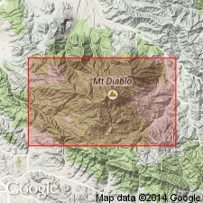
Occurs in vicinity of Mount Diablo Country Club on southwest side of Mount Diablo, [Diablo 7.5-min quadrangle], Contra Costa Co., northern CA.
Source: US geologic names lexicon (USGS Bull. 1200, p. 36); GNU records (USGS DDS-6; Menlo GNULEX).
- Usage in publication:
-
- Alamo formation†
- Modifications:
-
- Abandoned
- AAPG geologic province:
-
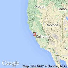
- Northern Coast Range province
- Sacramento basin
Summary:
Pg. 213. †Alamo formation (of early Pliocene age) as used by B.L. Clark [abs.], 1940 (GSA Bull, v. 51, no. 12, pt. 2, p. 1957) abandoned. Name preoccupied. Unit here is renamed Diablo formation for exposures near Diablo Post Office. Well preserved early Pliocene flora occur in brown semi-cherty mudstone near base of this unit.
[B.L. Clark concurs; see p. 585, chart 11, IN C.E. Weaver and others, 1944, GSA Bull., v. 55, no. 5.]
Source: US geologic names lexicon (USGS Bull. 1200, p. 36); GNU records (USGS DDS-6; Menlo GNULEX).
- Usage in publication:
-
- Alamo formation†
- Modifications:
-
- Abandoned
- AAPG geologic province:
-
- Sacramento basin
Summary:
†Alamo formation abandoned; formation renamed Diablo.
Source: US geologic names lexicon (USGS Bull. 1200, p. 36).
- Usage in publication:
-
- Alamo formation
- Modifications:
-
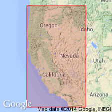
- [Areal extent]
- AAPG geologic province:
-
- Northern Coast Range province
Summary:
Pg. 76. Alamo formation. Mentioned as 1,000 feet of marine beds deposited above Neroly beds during [early] Pliocene.
Source: US geologic names lexicon (USGS Bull. 1200, p. 36).
For more information, please contact Nancy Stamm, Geologic Names Committee Secretary.
Asterisk (*) indicates published by U.S. Geological Survey authors.
"No current usage" (†) implies that a name has been abandoned or has fallen into disuse. Former usage and, if known, replacement name given in parentheses ( ).
Slash (/) indicates name conflicts with nomenclatural guidelines (CSN, 1933; ACSN, 1961, 1970; NACSN, 1983, 2005, 2021). May be explained within brackets ([ ]).