The National Geologic Map Database is migrating to a new infrastructure. We apologize for any service disruptions during this process.
|
|---|


- Usage in publication:
-
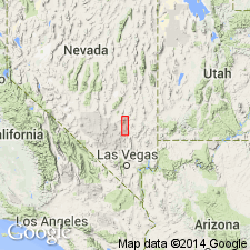
- Alamo Range Formation
- Modifications:
-
- Original reference
- Dominant lithology:
-
- Tuff
- AAPG geologic province:
-
- Great Basin province
Summary:
Pg. 879 (fig. 1), 888-890, pl. 1, App. Alamo Range Formation. Consists of semi-consolidated pumiceous vitric tuff overlain by welded vitric tuff, locally underlain by water-laid tuff, in part one cooling unit. Thickness 400 to 1,000 feet. Overlies Hiko Tuff (new); underlies Badger Valley Basalts (new). Age is Miocene.
Type area: Alamo Range, Lincoln Co., NV. Section measured 100 yds north of Alamo Canyon road, in central part of T. 7 S., R. 61 E., about 1.5 mi east of U.S. Highway 93.
Source: US geologic names lexicon (USGS Bull. 1350, p. 11).
For more information, please contact Nancy Stamm, Geologic Names Committee Secretary.
Asterisk (*) indicates published by U.S. Geological Survey authors.
"No current usage" (†) implies that a name has been abandoned or has fallen into disuse. Former usage and, if known, replacement name given in parentheses ( ).
Slash (/) indicates name conflicts with nomenclatural guidelines (CSN, 1933; ACSN, 1961, 1970; NACSN, 1983, 2005, 2021). May be explained within brackets ([ ]).