The National Geologic Map Database is migrating to a new infrastructure. We apologize for any service disruptions during this process.
|
|---|


- Usage in publication:
-
- Alamo Bluff bed
- Modifications:
-
- Original reference
- Dominant lithology:
-
- Lignite
- Shale
- AAPG geologic province:
-
- Williston basin
Summary:
Pg. 252. (This report supersedes W.E. Benson, 1951, Geologic maps of Medicine Butte, Broncho, Golden Valley, Beulah, Stanton, and Hazen quadrangles, North Dakota: USGS Open-File Report, OF-51-21.) Alamo Bluff bed. The kaolin clay beds of the lower member of the Golden Valley formation are characteristically capped by a thin impure lignite or carbonaceous shale, which locally thickens to a coal bed 2 to 6 feet thick. In the Broncho quadrangle this has been called the Alamo Bluff bed. The bed is too variable in thickness and quality to permit an accurate estimate of its reserves, but it probably has little or no commercial value. The local small pits 2 to 3 miles northeast of Dodge in the Golden Valley quadrangle are probably in the Alamo Bluff bed, but these pits were slumped in and a section of the bed could not be obtained.
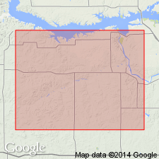
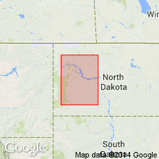
Named from exposure in a small escarpment near the ruins of an adobe house, facetiously called " the Alamo" by the Knife River party, in northeast corner of sec. 28, T. 143 N., R. 90 W., [approx. Lat. 47 deg. 10 min. 34.6 sec. N., Long. 102 deg. 05 min. 28.5 sec. W., Schaffner Creek NE 7.5-min quadrangle, Mercer Co., ND]. [Lat/Long coords, quadrangle, and county from Montana State Univ. TRS2LL conversion program.]
Source: Publication.
- Usage in publication:
-
- Alamo Bluff lignite
- Modifications:
-
- Revised
- AAPG geologic province:
-
- Williston basin
Summary:
Alamo Bluff lignite (informal). At some localities in western North Dakota (Williston basin), name applied to the uppermost beds (in uppermost carbonaceous zone) of the Bear Den Member (new), lower member (of 2) of the Golden Valley Formation. Thickness of Alamo Bluff averages 1.23 to 7.4 cm. Overlies unnamed claystone in the carbonaceous zone of the Bear Den. Underlies the Camels Butte Member (new), upper member of the Golden Valley. Is considered a lateral equivalent of the informal Taylor bed, a silicified siltstone bed 18 to 60 cm thick. Both Alamo Bluff and Taylor serve as valuable, persistent markers across the areal extent of the Golden Valley Formation. Relationship of Alamo Bluff and Taylor observed in the Taylor area, Stark County, North Dakota. East of Taylor, the Alamo Bluff transgressively replaces the Taylor bed. West of Taylor, the Taylor replaces the Alamo Bluff. Northwest of Taylor, the Alamo Bluff overlies the Taylor. Age is late Paleocene. Report includes cross sections, measured sections. [See also entry under Taylor.]
Source: Modified from GNU records (USGS DDS-6; Denver GNULEX).
For more information, please contact Nancy Stamm, Geologic Names Committee Secretary.
Asterisk (*) indicates published by U.S. Geological Survey authors.
"No current usage" (†) implies that a name has been abandoned or has fallen into disuse. Former usage and, if known, replacement name given in parentheses ( ).
Slash (/) indicates name conflicts with nomenclatural guidelines (CSN, 1933; ACSN, 1961, 1970; NACSN, 1983, 2005, 2021). May be explained within brackets ([ ]).