

- Usage in publication:
-
- Alachua clays*
- Modifications:
-
- Original reference
- Dominant lithology:
-
- Clay
- AAPG geologic province:
-
- Florida platform
Summary:
Pg. 127-130, 157, 320 [Mr. Dall's responsibility, see p. 2]. Alachua clays. Deposits of clay containing bones of extinct mammalia. These clays occur in sinks, gullies, and other depressions in Miocene, upper Eocene, and later rocks of Florida, especially on western anticline in higher parts of Alachua County, and along banks of many rivers and streams. They appear in Alachua County to have been subjected to denudation after deposition, so that only those parts protected by their depressed position in cavities or gullies of harder rock remain undisturbed. The clay is bluish or grayish and extremely tenacious, so that it is most difficult to discover remains embedded in it. Occurs in patches, usually in depressions, but occasionally in short ridges whose lateral buttresses of limerock have disappeared through dissolving agency of rain water and carbon dioxide. [Mentions many localities of its occurrence in Alachua County.] [Age is early Pliocene.]
[Named from its many exposures in Alachua Co., northern FL.]
Source: US geologic names lexicon (USGS Bull. 896, p. 21-22).

- Usage in publication:
-
- Alachua clay*
- Modifications:
-
- Revised
- AAPG geologic province:
-
- Florida platform
Summary:
Pg. 133. Alachua clay as here used includes "Peace Creek bone bed" of Dall, "which appears to be a local phase of the formation which may have been eroded and redeposited in its present condition." [Age is early Pliocene.]
Source: US geologic names lexicon (USGS Bull. 896, p. 21-22).
- Usage in publication:
-
- Alachua clay
- Dunnellon formation†
- Modifications:
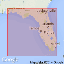
-
- Areal extent
- AAPG geologic province:
-
- Florida platform
Summary:
Pg. 161-162. Alachua clay and Dunnellon formation are merely different facies of a single formation, and Dunnellon should not be used any longer.
Source: US geologic names lexicon (USGS Bull. 896, p. 21-22).
- Usage in publication:
-
- Alachua formation*
- Modifications:
-
- Revised
- AAPG geologic province:
-
- Florida platform
Summary:
Alachua formation. Is here used to include "Dunnellon" formation, discarded by Sellards. The Alachua is a residual deposit derived from Hawthorn formation and containing Pliocene fossils. It unconformably overlies Ocala limestone or Tampa limestone and is overlain by loose wind-blown sand. The part of formation to which name Alachua was originally applied consists chiefly of clay, accumulated in ponds or sinks, and at least 15 feet thick. Great bulk of formation that Sellards called "Dunnellon" is chiefly compact white or gray sand, closely resembling the sand in Hawthorn formation, from which it no doubt is derived. Greater part of Alachua formation seems not to have been laid down under water. Sellards gives thickness of "Dunnellon" formation as 75 to 100 feet. [Age is early Pliocene.]
Source: US geologic names lexicon (USGS Bull. 896, p. 21-22).
- Usage in publication:
-
- Alachua [formation]
- Modifications:
-
- Age modified
- AAPG geologic province:
-
- Florida platform
Summary:
Pg. 13, pl. 1. Alachua [formation]. Age is [middle Pliocene]; Hemphillian.
Source: US geologic names lexicon (USGS Bull. 1200, p. 34-35).
- Usage in publication:
-
- Alachua formation
- Modifications:
-
- Areal extent
- AAPG geologic province:
-
- Florida platform
Summary:
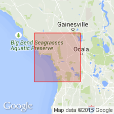
Pg. 189-208. Alachua formation. As described in Citrus and Levy Counties, northern Florida, Alachua includes terrestrial deposits of diverse lithology, but is composed largely of clays, fine sands, and a basal rubble of phosphate rock, silicified wood, clay beds, and silicified Suwannee and Ocala limestone residuum. Sediments rest on bedrock of limestone ranging in age from middle Eocene to Oligocene, except in Citrus County where they interfinger with, and, in part, lie upon Hawthorn formation. Unconformably overlain by fine to medium quartz sand containing no phosphate and believed to be early Pleistocene in age. Undetermined phosphate clay mineral forms matrix for much of fine sand and phosphate rubble, and Alachua formation is characterized by presence of this mineral and by fairly numerous specimens of vertebrate remains contained in sinks and depressions. These vertebrates range in age from lower Miocene into Pleistocene, and sediments of formation may have accumulated not only throughout Miocene epoch but also during period extending into Pleistocene. No stratigraphic relationships were determined during identification of vertebrate fossils, and presence of Pliocene and Pleistocene fossils may represent contamination by entrapment of these animals during epochs following Miocene. Maximum thickness about 66 feet.
Source: US geologic names lexicon (USGS Bull. 1200, p. 34-35).
- Usage in publication:
-
- Alachua Formation
- Modifications:
-
- Age modified
- AAPG geologic province:
-
- Florida platform
Summary:
Author states unit is often misused and misunderstood. Further research necessary to understand and delineate this complex unit. Age may range from Miocene to Pleistocene in a multiple phase development. Not considered part of Hawthorn Group, but derived from it.
Source: GNU records (USGS DDS-6; Reston GNULEX).
For more information, please contact Nancy Stamm, Geologic Names Committee Secretary.
Asterisk (*) indicates published by U.S. Geological Survey authors.
"No current usage" (†) implies that a name has been abandoned or has fallen into disuse. Former usage and, if known, replacement name given in parentheses ( ).
Slash (/) indicates name conflicts with nomenclatural guidelines (CSN, 1933; ACSN, 1961, 1970; NACSN, 1983, 2005, 2021). May be explained within brackets ([ ]).