The National Geologic Map Database is migrating to a new infrastructure. We apologize for any service disruptions during this process.
|
|---|


- Usage in publication:
-
- Alabama Hills Granite*
- Modifications:
-
- Original reference
- Dominant lithology:
-
- Monzogranite
- AAPG geologic province:
-
- Great Basin province
Summary:
Alabama Hills Granite. Very pale orange to pinkish gray, hypidiomorphic seriate to faintly porphyritic, medium-grained biotite monzogranite. Underlies an area of about 35 sq km in the Alabama Hills, Inyo County, central eastern California. In places, includes fine-grained hypabyssal(?) facies. Locally contains pale-pink phenocrysts of potassium feldspar as large as 1 cm, abundant aplite, and rare pegmatite dikes. Includes small pendant of Paleozoic(?) calcitic marble and calc-hornfels in NE/4 sec. 13, T. 15 S., R. 35 E. Intrudes upper part of informal volcanic complex of Alabama Hills (Middle Jurassic). Is broadly coeval with granodioritic plutons of Mount Whitney Intrusive Suite in Sierra Nevada; this pluton is distinctly less mafic and is interpreted to represent a separate intrusive mass. Age is Late Cretaceous. Biotite K-Ar age of ~82 Ma (Evernden and Kistler, 1970, USGS Prof. Paper 623); preferred U-Pb age of ~85 Ma (Chen and Moore, 1982, Geology, v. 7).
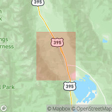
Type locality: a few mi west of Lone Pine, on the north side of Whitney Portal Road 400 m east of the junction with Movie Road, in S/2 sec. 30, T. 15 S., R. 36 E., [approx. Lat. 36 deg. 35 min. 42 sec. N., Long. 118 deg. 06 min. 15 sec. W.], Lone Pine 15-min quadrangle, Alabama Hills Recreation Area, Inyo Co., central eastern CA. [Named from Alabama Hills, Inyo Co., central eastern CA].
[Additional locality information from USGS historical topographic map collection TopoView, accessed February 1, 2023.]
Source: Publication.
For more information, please contact Nancy Stamm, Geologic Names Committee Secretary.
Asterisk (*) indicates published by U.S. Geological Survey authors.
"No current usage" (†) implies that a name has been abandoned or has fallen into disuse. Former usage and, if known, replacement name given in parentheses ( ).
Slash (/) indicates name conflicts with nomenclatural guidelines (CSN, 1933; ACSN, 1961, 1970; NACSN, 1983, 2005, 2021). May be explained within brackets ([ ]).