

- Usage in publication:
-
- Ahtell diorite*
- Modifications:
-
- Original reference
- Dominant lithology:
-
- Quartz diorite
- AAPG geologic province:
-
- Alaska Southern region
Summary:
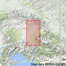
Pg. 38, map. Ahtell diorite. Intrusive. Chiefly quartz diorite or quartz diorite porphyry, often pink or pale brownish red in color. Probably mainly upper Carboniferous and perhaps extending into Permian. Composes hills drained by west tributaries of Ahtell Creek, central Copper River region, southeastern AK. [Well exposed in walls of pass which leads north from West Fork of Indian Creek to southern tributary of Slana River.]
Source: US geologic names lexicon (USGS Bull. 896, p. 18); supplemental information from GNU records (USGS DDS-6; Menlo GNULEX).
For more information, please contact Nancy Stamm, Geologic Names Committee Secretary.
Asterisk (*) indicates published by U.S. Geological Survey authors.
"No current usage" (†) implies that a name has been abandoned or has fallen into disuse. Former usage and, if known, replacement name given in parentheses ( ).
Slash (/) indicates name conflicts with nomenclatural guidelines (CSN, 1933; ACSN, 1961, 1970; NACSN, 1983, 2005, 2021). May be explained within brackets ([ ]).