The National Geologic Map Database is migrating to a new infrastructure. We apologize for any service disruptions during this process.
|
|---|


- Usage in publication:
-
- Aguajito Shale Member
- Modifications:
-
- Original reference
- Dominant lithology:
-
- Shale
- Porcellanite
- AAPG geologic province:
-
- Coastal basins
Summary:
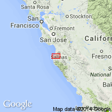
Aguajito Shale Member; name applied to middle member of Monterey Formation in type area. Includes Galliher's (Micropaleontology Bull., v. 2, no. 4, 1931) units 2 and 3. Characteristically consists of thin-bedded opaline shale or porcellanite. Beds range from fraction of an inch to several inches in thickness. On Ranchos Aguajito and Canada de la Segunda, which occupy most of the high-lands between Carmel Valley and Canyon del Rey east of state Highway 1, member reaches thickness of about 2,000 feet or two-thirds of bulk of Monterey Formation as a whole. The Aguajito grades into underlying Los Laureles Sandstone Member (new) below and Canyon del Rey Diatomite Member (new) above. Predominantly upper Miocene although lowermost beds contain Luisian Foraminifera in some localities. A few of upper beds contain Delmontian microfauna. Nowhere is Delmontian part of unit known to be more than 300 feet thick and Luisian part more than 200 feet thick. Age is late Miocene.
Type section: same as Monterey Formation of Galliher (1931, Micropaleo. Bull., v. 2, no. 4), between Canyon Del Ray and San Jose Canyon along axis of Canyon Segundo, west-central CA. Named from exposures on Rancho Aguajito. Shale is almost continuously exposed over 44 sq mi and underlies at least 100 sq mi in Monterey and Salinas quadrangles.
Source: US geologic names lexicon (USGS Bull. 1350, p. 8-9).
For more information, please contact Nancy Stamm, Geologic Names Committee Secretary.
Asterisk (*) indicates published by U.S. Geological Survey authors.
"No current usage" (†) implies that a name has been abandoned or has fallen into disuse. Former usage and, if known, replacement name given in parentheses ( ).
Slash (/) indicates name conflicts with nomenclatural guidelines (CSN, 1933; ACSN, 1961, 1970; NACSN, 1983, 2005, 2021). May be explained within brackets ([ ]).