- Usage in publication:
-
- Afton Basalt
- Modifications:
-
- First used
- Dominant lithology:
-
- Basalt
- AAPG geologic province:
-
- Orogrande basin
Summary:
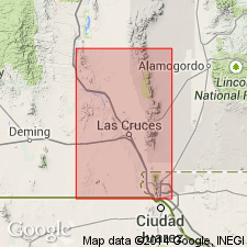
First published description; first noted on chart only (Hawley, 1970). Report area is south-central Dona Ana Co, NM, central part of Potrillo Volcanic field, Orogrande basin. "Aden-Afton Basalts" lie in a graben bounded on east and west by faults; downthrown fault on west side recognized in the field by a series of elongate shallow depressions north and south of the field. The fault cannot be traced into the field but its position is inferred by alignment of trough depressions, cinder cones, and maar craters. Three periods of basalt extrusion are associated with this fracture: they are termed Af1, Af2, and Af3 in order of decreasing age (Hoffer, 1973). Shown on chart as extending from northwest of Gardner Ranch south about 11 mi to south of Hunt's Hole, a maar volcano. Basal Afton flow is a 12-ft-thick olivine basalt, dense and porphyritic with predominantly olivine phenocrysts. Vesicular lenses locally abundant near bases of flow; these are described as pipe vesicles. Outcrops in the rim of Hunt's Hole and on the La Mesa surface (present basin surface) south and east of Hunt's Hole. Afton Basalt is thought to be older than Aden Basalt based on heavier cover of recent blowsand and apparent onlap of the middle Afton flow (Af2) by the Aden lavas. Both Aden and Afton overlie rocks of Santa Fe Group. Quaternary in age.
Source: GNU records (USGS DDS-6; Denver GNULEX).

- Usage in publication:
-
- Afton flows
- Modifications:
-
- Geochronologic dating
- AAPG geologic province:
-
- Orogrande basin
Summary:
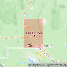
The Aden-Afton basalt [author lumps these two flows together] crops out over approximately 50 sq mi in central Potrillo field, east flank of West Potrillo Mountains, Dona Ana Co, NM, Orogrande basin. The two Aden flows are those that crop out in Aden crater and adjacent areas north, east, and southeast of the crater; the three Afton flows are those that crop out south of Afton, east of the Aden flows. Afton flows are thought to be older than Eden because of greater degree of weathering, heavier cover of blow sand, and apparent onlap of the middle Afton flow by the Aden lavas. Oldest Afton flow, exposed in walls of Kilbourne Hole and Hunts Hole (maar volcanoes) gave K-Ar whole-rock dates of 141,000 +/-75,000 yrs and 103,000 +/-84,000 yrs (R. E. Denison, 1970, written communication).
Source: GNU records (USGS DDS-6; Denver GNULEX).
For more information, please contact Nancy Stamm, Geologic Names Committee Secretary.
Asterisk (*) indicates published by U.S. Geological Survey authors.
"No current usage" (†) implies that a name has been abandoned or has fallen into disuse. Former usage and, if known, replacement name given in parentheses ( ).
Slash (/) indicates name conflicts with nomenclatural guidelines (CSN, 1933; ACSN, 1961, 1970; NACSN, 1983, 2005, 2021). May be explained within brackets ([ ]).

