

- Usage in publication:
-
- Admiralty Island Volcanics*
- Modifications:
-
- Original reference
- Dominant lithology:
-
- Andesite
- Basalt
- AAPG geologic province:
-
- Alaska Southeastern region
Summary:
Pg. 11 (table 1), 79-87, pl. 1. Admiralty Island Volcanics. Name proposed for thick sequence of gently dipping andesitic and basaltic flows and minor rhyolitic breccia and tuff that crops out in southwestern part of Pybus-Gambier area. Individual flows range in thickness from 10 to 50 feet and form regular layered sequence in which some flows seem to persist for miles. Thickness at least 9,500 feet west of Cannery Cove. Thins southward to less than 5,000 feet near Little Pybus Bay. Conformably overlie unnamed conglomerate and sandstone unit in Little Pybus Bay area. From Cannery Cove northwestward overlie deformed pre-Tertiary rocks with marked angular unconformity. Overlain by scattered unconsolidated deposits of Quaternary age. Age is late Eocene and Oligocene based on stratigraphic relations.
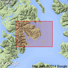
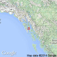
Named from outcrops in southwestern part of Pybus-Gambier area of Admiralty Island, southeastern AK. Typically exposed west and north of Little Pybus Bay. Covers about 300 sq mi of southern Admiralty Island.
Source: US geologic names lexicon (USGS Bull. 1350, p. 7); supplemental information from GNU records (USGS DDS-6; Menlo GNULEX).
- Usage in publication:
-
- Admiralty Island Volcanics*
- Modifications:
-
- Age modified
- Geochronologic dating
- AAPG geologic province:
-
- Alaska Southeastern region
Summary:
Age of the Admiralty Island Volcanics is revised from Eocene and Oligocene to: Oligocene based on an isotopic age (K-Ar) of 27 Ma (near head of Chaik Bay, Admiralty Island) for rocks of the unit and regional stratigraphic relations.
Source: GNU records (USGS DDS-6; Menlo GNULEX).
For more information, please contact Nancy Stamm, Geologic Names Committee Secretary.
Asterisk (*) indicates published by U.S. Geological Survey authors.
"No current usage" (†) implies that a name has been abandoned or has fallen into disuse. Former usage and, if known, replacement name given in parentheses ( ).
Slash (/) indicates name conflicts with nomenclatural guidelines (CSN, 1933; ACSN, 1961, 1970; NACSN, 1983, 2005, 2021). May be explained within brackets ([ ]).