The National Geologic Map Database is migrating to a new infrastructure. We apologize for any service disruptions during this process.
|
|---|


- Usage in publication:
-
- Adel Mountain volcanics*
- Modifications:
-
- Original reference
- AAPG geologic province:
-
- Sweetgrass arch
Summary:
Pg. 449 (fig. 2), 455, 459-460, pl. 1. Adel Mountain volcanics. Trachybasalt and basalt agglomerates, conglomerates, and flows, with numerous intrusives, analcime and augite trachybasalts in upper measures. Contains plant fossils in upper conglomerates. Entire succession strongly zeolitized. Unconformably underlies Great Falls lake sands (new); unconformably overlies Two Mdicine formation. Thickness 3,200 feet. In area of Lewis overthrust, Precambrian Spokane shale is thrust over Adel Mountain volcanics. Age is Late Cretaceous.
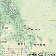
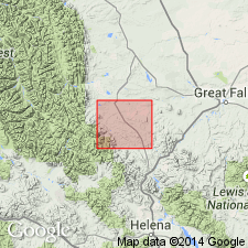
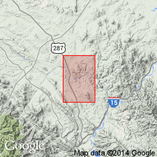
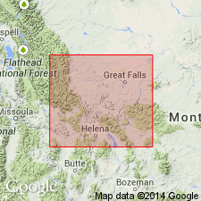
[Type locality not designated.] Occupies approx. 330 sq mi of northern Big Belts, northwestern MT.
[Adel Mountain (now Sieben), Lat. 47 deg. 04 min. 34 sec. N., Long. 111 deg. 42 min. 24 sec. W, Hound Creek Reservoir 7.5-min quadrangle, Cascade Co., northwestern MT (USGS GNIS database; accessed November 05, 2011).]
Source: US geologic names lexicon (USGS Bull. 1200, p. 19).
- Usage in publication:
-
- Adel Mountain Volcanics
- Modifications:
-
- Overview
- AAPG geologic province:
-
- Montana folded belt
- Sweetgrass arch
Summary:
Is formation mapped in Lewis and Clark Co, MT in Montana folded belt province and Cascade Co, MT on Sweetgrass arch. Lower contact is generally unconformable on the DE tongue of the Upper Cretaceous Big Skunk Formation (new). Basal part composed of light, olive-gray (5Y 6/1), volcanic-rich, fine-grained, arkosic sandstones about 15-20 ft thick. Fine-grained sandstone grades upward to conglomeratic beds with pebbles of porphyritic diorite, which are overlain by massive-weathering outcrops of volcanic agglomerate and breccia. Main mass of the unit is dark gray to greenish black (5GY 2/1) breccia that is very thick bedded and generally massive; angular boulders and cobbles as much as 6-8 ft in diameter are mostly augite-bearing basalts and andesites; matrix of breccia is granular and medium to coarse grained; lack of vesiculation, glass, and flow structure suggests mud-flow deposition; locally, plugs of non-bedded tuff-breccia truncate roughly defined bedding planes in the breccia, suggesting the plugs may have formed by gas explosions within a laharic flow. Locally, thick sill (or possibly a flow) of augite-bearing basalt, overlies red beds that include strata of cinder, lapilli tuff, and lapilli-tuff breccia, which in turn overlie the basal breccia. Age is Late Cretaceous and Tertiary.
Source: GNU records (USGS DDS-6; Denver GNULEX).
- Usage in publication:
-
- Adel Mountain Volcanics*
- Modifications:
-
- Mapped 1:24k (Coburn Mountain quad, Cascade and Lewis and Clark Cos, MT)
- Dominant lithology:
-
- Breccia
- Trachybasalt
- Trachyandesite
- Conglomerate
- AAPG geologic province:
-
- Montana folded belt
- Sweetgrass arch
Summary:
Mapped as 5 units in western Cascade Co, MT on Sweetgrass arch and in eastern Lewis and Clark Co, MT, Montana folded belt province; (ascending): 1) volcanic breccia (dark red, purplish red, and dark grayish green; angular clasts of trachybasalt and trachyandesite in matrix of coarse tuff; lower part massive and coarse with clasts as much as 12 ft across; upper part poorly stratified and less coarse with thin volcanic conglomerate and sandstone lenses; about 1,200 ft); 2) trachybasalt flow (dark gray, brown weathered; coarsely porphyritic with phenocrysts of augite in aphanitic groundmass; labradorite, sanidine, augite, olivine, and magnetite; may include a few sills and small irregular intrusive bodies; maximum thickness of individual flows about 30 ft); 3) trachyandesite flow (gray to light brownish gray, tan weathered; massive and finely porphyritic; andesine, sanidine, augite, olivine, biotite, and magnetite; about 40 ft thick); 4) lacustrine deposits (gray, brown, and yellowish-brown volcanic sandstone, siltstone, and mudstone in thin beds; thin bed of ash-fall tuff locally near base; plant fragments abundant; feather edge to 500 ft); 5) volcanic conglomerate (red and purplish red, poorly sorted, indistinctly bedded; clasts (pebble size to 2 ft) of trachybasalt, trachyandesite, latite, and quartz latite; few thin interbeds of red and purplish-gray volcanic sandstone, siltstone, and mudstone; about 1,200 ft). Tertiary? age.
Source: GNU records (USGS DDS-6; Denver GNULEX).
- Usage in publication:
-
- Adel Mountain volcanic rocks
- Modifications:
-
- Geochronologic dating
- AAPG geologic province:
-
- Montana folded belt
- Sweetgrass arch
Summary:
[Term Adel Mountain Volcanics not used.] The volcanic field covers an area of about 900 sq km in western MT in Lewis and Clark Co, Montana folded belt province, and adjacent Cascade Co, Sweetgrass arch. The volcanic rocks unconformably overlie Cretaceous rocks. Adel Mountain rocks include flows, flow breccias, volcanic conglomerates and associated intrusive rocks that have been mildly deformed. The southwest edge of the field was deformed by Late Cretaceous to Paleocene folding and thrusting. Two age dates obtained from shonkinites in Cascade Co--one has a whole rock K-Ar date of 81.1 +/-3.5 Ma from a flow deep in the pile and the other a K-Ar date on biotite of 71.2 +/-2.7 Ma on a dike that cross-cut the pile. These dates are consistent with paleomagnetic information of normal polarity on 34 flows or dikes that crosscut the older flows. The dikes range from tens of centimeters to tens of meters in width.
Source: GNU records (USGS DDS-6; Denver GNULEX).
- Usage in publication:
-
- Adel Mountain Volcanics*
- Modifications:
-
- Geochronologic dating
- AAPG geologic province:
-
- Montana folded belt
Summary:
Adel Mountain Volcanics and associated intrusions were probably emplaced over a short interval of time about 74 Ma, or Late Cretaceous. The area studied is located in southwest MT, southwest of Great Falls in Madison Co. in the Montana folded belt province. Consists of the trachybasalt lava flows, volcanic breccias, and volcaniclastic sedimentary rocks; these rocks were cut by dikes, sills, plugs, and stocks or laccoliths. Biotite separate from a breccia clast near base of formation yielded a K-Ar date of 73.2 +/-2.1 Ma. Biotite and hornblende separates from dikes that cross-cut the volcanics range from 73 to 75 Ma.
Source: GNU records (USGS DDS-6; Denver GNULEX).
For more information, please contact Nancy Stamm, Geologic Names Committee Secretary.
Asterisk (*) indicates published by U.S. Geological Survey authors.
"No current usage" (†) implies that a name has been abandoned or has fallen into disuse. Former usage and, if known, replacement name given in parentheses ( ).
Slash (/) indicates name conflicts with nomenclatural guidelines (CSN, 1933; ACSN, 1961, 1970; NACSN, 1983, 2005, 2021). May be explained within brackets ([ ]).