- Usage in publication:
-
- Addington formation
- Modifications:
-
- Original reference
- Dominant lithology:
-
- Shale
- Sandstone
- AAPG geologic province:
-
- South Oklahoma folded belt
Summary:
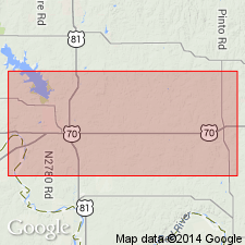
Pg. 8-9, etc. Addington formation. Uppermost member of red beds exposed in Jefferson County, central southern Oklahoma. Few feet to several hundred feet thick; maximum thickness on high bluffs just east of Addington (Jefferson County). Is characterized by the brilliant red and vermilion hues of its shale members, which are often broken by white and light-gray shale and sandy shale streaks. The sandstones are characterized by black red color and slabby appearance on weathering. The weathered slabs are extremely hard and resistant. When freshly broken they resemble fine-grained reddish quartzite. In general the sandstones show varying amount of pink or red color unless subjected to constant water saturation. In which case they are sometimes soft and light colored. Base is generally characterized by thin to massive, resistant, reddish sandstone. There is some evidence these beds are not entirely conformable with underlying Claypool formation (Pennsylvanian). The Addington contains the only beds in county that are typical of lower Permian red beds of Oklahoma. Assigned to Permian.
Source: US geologic names lexicon (USGS Bull. 896, p. 13-14).
- Usage in publication:
-
- Addington formation
- Modifications:
-
- Not used
Branson, C.C., 1957, Rejected Oklahoma stratigraphic names: Oklahoma Geology Notes, v. 17, no. 11, p. 106-108.
Summary:
Pg. 106. Addington formation. Rejected by the Oklahoma Geological Survey. Name preoccupied.
Source: US geologic names lexicon (USGS Bull. 1200, p. 18).

- Usage in publication:
-
- Addington Formation
- Modifications:
-
- Not used
- AAPG geologic province:
-
- South Oklahoma folded belt
Summary:
[1967 ed. of this map.] Red Permian rocks in OK part of map sheet (southern Jefferson Co, OK in S. Oklahoma folded belt province) have been mapped as Addington Formation by Frederickson and Redman (1965). Addington not used in this map sheet; these rocks mapped as the uppermost of seven mudstone and sandstone units included under the general term "Permian rocks above Graham Formation." Map unit P6 is 80 ft thick and is 60 percent mudstone.
Source: GNU records (USGS DDS-6; Denver GNULEX).
For more information, please contact Nancy Stamm, Geologic Names Committee Secretary.
Asterisk (*) indicates published by U.S. Geological Survey authors.
"No current usage" (†) implies that a name has been abandoned or has fallen into disuse. Former usage and, if known, replacement name given in parentheses ( ).
Slash (/) indicates name conflicts with nomenclatural guidelines (CSN, 1933; ACSN, 1961, 1970; NACSN, 1983, 2005, 2021). May be explained within brackets ([ ]).

