The National Geologic Map Database is migrating to a new infrastructure. We apologize for any service disruptions during this process.
|
|---|


- Usage in publication:
-
- Adamant granite*
- Modifications:
-
- Original reference
- Dominant lithology:
-
- Granite
- AAPG geologic province:
-
- New England province
Summary:
Adamant granite. Mottled gray fine- to medium-grained granite, occurring as thick sills, thinner subsidiary sills, and sill-like dikes. Maximum thickness of individual sills several hundred feet. Enclosed in Waits River formation, except for one thin sill in Moretown formation. Age is Devonian.
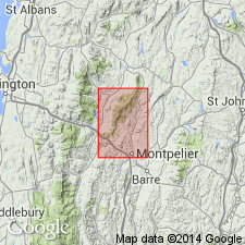
Typically exposed at surface and in quarries within a mi north and northwest of village of Adamant in southwestern Calais Twp., Montpelier quadrangle, central VT.
Source: US geologic names lexicon (USGS Bull. 1200, p. 17-18).
For more information, please contact Nancy Stamm, Geologic Names Committee Secretary.
Asterisk (*) indicates published by U.S. Geological Survey authors.
"No current usage" (†) implies that a name has been abandoned or has fallen into disuse. Former usage and, if known, replacement name given in parentheses ( ).
Slash (/) indicates name conflicts with nomenclatural guidelines (CSN, 1933; ACSN, 1961, 1970; NACSN, 1983, 2005, 2021). May be explained within brackets ([ ]).