- Usage in publication:
-
- Ada shale
- Modifications:
-
- Original reference
- Dominant lithology:
-
- Shale
- AAPG geologic province:
-
- Appalachian basin
Summary:
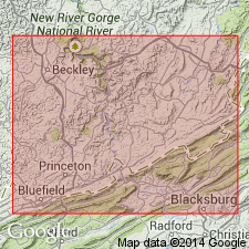
Pg. 300, 421. Ada shale. Olive green, fissile, calcareous toward base, 30 to 60 feet thick. Marine fossils. Underlies Talcott shale and overlies Reynolds limestone, all members of Bluefield group [formation]. Type locality on north side of East River, in public road between Ada and Stony Gap, and less than 0.25 mile west of Ada, Mercer County, West Virginia. Also observed in Monroe and Summers Counties, West Virginia; in Tazewell County, Virginia; and far down in Tennessee, being quite typical at Daisy, Hamilton County. Can be traced northeastward in West Virginia nearly to head of Greenbrier Valley and possibly to southern Pennsylvania.
[GNC remark (ca. 1938, US geologic names lexicon, USGS Bull. 896, p. 12): Ada shale in Bluefield formation. Present in southeastern West Virginia, southwestern Virginia (Tazewell County), and eastern Tennessee(?). Age is Mississippian.]
Source: US geologic names lexicon (USGS Bull. 896, p. 12).
For more information, please contact Nancy Stamm, Geologic Names Committee Secretary.
Asterisk (*) indicates published by U.S. Geological Survey authors.
"No current usage" (†) implies that a name has been abandoned or has fallen into disuse. Former usage and, if known, replacement name given in parentheses ( ).
Slash (/) indicates name conflicts with nomenclatural guidelines (CSN, 1933; ACSN, 1961, 1970; NACSN, 1983, 2005, 2021). May be explained within brackets ([ ]).

