The National Geologic Map Database is migrating to a new infrastructure. We apologize for any service disruptions during this process.
|
|---|


- Usage in publication:
-
- Acme dolomite
- Modifications:
-
- Original reference
- Dominant lithology:
-
- Dolomite
- AAPG geologic province:
-
- Permian basin
- Palo Duro basin
Summary:
Pg. 951, pl. 9. Acme dolomite in Blaine formation of Double Mountain group. Above Mangum dolomite the first prominent dolomite is a series of several beds, 1 to 6 feet thick, which has been called the Acme, from its type exposure in Hardeman County, where thick beds of gypsum below the dolomite are mined. The Acme is traced southward to Stonewall County and may be correlated with reasonable certainty with McCaulley beds of Fisher County. It lies 64 feet above Mangum dolomite and 90 feet below Guthrie dolomite, all in Blaine formation. Age is Late Permian. See also [1932] entry under McCaulley dolomite.
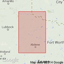
Type exposure: [town of Acme] in Hardeman Co., TX.
[Town of Acme (historical), a mining center for gypsum from the 1890s to 1940s, located at Lat. 34 deg. 19 min. 00 sec. N., Long. 99 deg. 49 min. 26 sec. W., Quanah West 7.5-min quadrangle, Hardeman Co., TX (USGenWeb Project, usgenweb.org, and USGS GNIS database; accessed November 19, 2013).]
Source: US geologic names lexicon (USGS Bull. 896, p. 11-12).
- Usage in publication:
-
- Acme dolomite bed
- Modifications:
-
- Reference
- AAPG geologic province:
-
- South Oklahoma folded belt
- Palo Duro basin
Summary:
Acme dolomite bed occurs at base of unit 6 of the Van Vacter Member (revised) of Blaine Formation of El Reno Group. In one measured section, is a gray dolomite, 2.2 feet thick. In reference section, consists of two gray dolomites separated by a white gypsum, 8.3 feet thick. Recognized in Greer and Harman Counties, southern Oklahoma. Underlies Dog Creek Shale of El Reno Group. Age is Permian. Report includes cross sections. Also mapped in Texas.
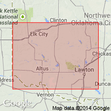
Reference section: in NE/4 sec. 11 and SE/4 sec. 1, T. 1 N., R. 26 W., [approx. Lat. 34 deg. 34 min. 22 sec. N., Long. 99 deg. 54 min. 10 sec. W., Hollis SW 7.5-min quadrangle, Harmon Co.], southern OK.
Source: Modified from GNU records (USGS DDS-6; Denver GNULEX).

- Usage in publication:
-
- Acme Dolomite [unranked]
- Modifications:
-
- Mapped 1:250k
- Dominant lithology:
-
- Dolomite
- AAPG geologic province:
-
- Palo Duro basin
- Permian basin
Summary:
Acme Dolomite [unranked] in middle part of Blaine Formation. Age is Permian.
[Mapped in Cottle, Foard, King, and Stonewall Cos., TX.]
Source: Publication.
For more information, please contact Nancy Stamm, Geologic Names Committee Secretary.
Asterisk (*) indicates published by U.S. Geological Survey authors.
"No current usage" (†) implies that a name has been abandoned or has fallen into disuse. Former usage and, if known, replacement name given in parentheses ( ).
Slash (/) indicates name conflicts with nomenclatural guidelines (CSN, 1933; ACSN, 1961, 1970; NACSN, 1983, 2005, 2021). May be explained within brackets ([ ]).