

- Usage in publication:
-
- Ackerman beds*
- Modifications:
-
- Original reference
- Dominant lithology:
-
- Clay
- AAPG geologic province:
-
- Black Warrior basin
Summary:
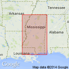
Pg. 23-55. Lowest division of Wilcox formation might well be called Ackerman beds, because typically exhibited in great cut 1 mi east of town of Ackerman, [Choctaw County, northeastern Mississippi]. Consists of dark-gray clays and sandy clays, lignite clays and lignite with occasional beds and concretionary masses of carbonate ore. Thickness 400 feet. Underlies Holly Springs sand and conformably overlies Midway group. Age is early Eocene.
[Named from] town of Ackerman, [Choctaw Co., northeastern MS].
Source: US geologic names lexicon (USGS Bull. 896, p. 11).

- Usage in publication:
-
- Ackerman formation*
- Modifications:
-
- Overview
- AAPG geologic province:
-
- Mid-Gulf Coast basin
- Black Warrior basin
Summary:
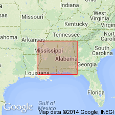
In present [ca. 1938] usage of names the Wilcox is treated as a group and the Ackerman as basal formation of that group. The Ackerman represents lower part of Nanafalia formation of Alabama as originally defined, but Nanafalia formation has been restricted by C.W. Cooke to beds overlying Ackerman formation (†Coal Bluff beds of early Alabama reports), which extends a short distance into Alabama. Age is early Eocene. (See under Nanafalia formation, also under †Coal Bluff beds.)
Source: US geologic names lexicon (USGS Bull. 896, p. 11).
- Usage in publication:
-
- Ackerman formation
- Modifications:
-
- Revised
- AAPG geologic province:
-
- Black Warrior basin
Summary:
Pg. 30 (fig. 6), 33, 37-43. Ackerman formation. Restricted to exclude Midway-Wilcox "transitional beds" or "basal clays" of Lowe. As thus restricted, underlies Holly Springs formation and overlies Fearn Springs formation (new) and includes not only clays and lignites as exposed in type section but a persistent basal sand member. Age is early Eocene.
Source: US geologic names lexicon (USGS Bull. 1200, p. 15-16); supplemental information from GNU records (USGS DDS-6; Reston GNULEX).
- Usage in publication:
-
- Ackerman formation
- Modifications:
-
- Areal extent
- AAPG geologic province:
-
- Upper Mississippi embayment
Summary:
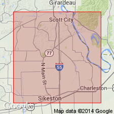
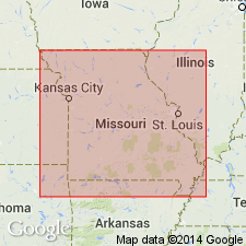
Pg. 159. Ackerman formation. Geographically extended into Scott County, Missouri, where it underlies Holly Springs formation and overlies Porters Creek formation. Age is early Eocene.
Source: US geologic names lexicon (USGS Bull. 1200, p. 15-16); supplemental information from GNU records (USGS DDS-6; Reston GNULEX).
- Usage in publication:
-
- Ackerman formation†
- Modifications:
-
- Abandoned
- AAPG geologic province:
-
- Black Warrior basin
Summary:
Pg. 17-18. †Ackerman formation. In 1943, during work on the Mississippi geologic map, it was found that type Holly Springs of northern Mississippi, formerly included in the Wilcox and correlated with Tuscahoma sand of Alabama, is nonmarine equivalent of Tallahatta formation to the south. Name Holly Springs was abandoned in favor of Tallahatta for all of Mississippi. Removal of beds designated as Holly Springs from Wilcox group left Ackerman formation as only unit formerly recognized by the USGS in the Wilcox of Mississippi. Although usually correlated with Nanafalia formation of Alabama, Ackerman at its type locality in Mississippi was found to correlate with beds well up in Tuscahoma sand of Alabama. It was decided, rather than attempt to redefine Ackerman, to adopt Wilcox formation for all beds of Wilcox age in Mississippi. [Hence, Ackerman formation is abandoned.]
[GNU remark (July 15, 1991, USGS DDS-6; Reston GNULEX): Ackerman formation is here abandoned only by the USGS. It continues to be used by the State Surveys.]
Source: US geologic names lexicon (USGS Bull. 1200, p. 15-16); supplemental information from GNU records (USGS DDS-6; Reston GNULEX).
- Usage in publication:
-
- Ackerman formation
- Modifications:
-
- Areal extent
- AAPG geologic province:
-
- Upper Mississippi embayment
Summary:
Pg. 843 (fig. 2), 844-845. Ackerman formation. Geographically extended into western Tennessee where it underlies Holly Springs formation and overlies Porters Creek clay. Age is early Eocene.
Source: US geologic names lexicon (USGS Bull. 1200, p. 15-16); supplemental information from GNU records (USGS DDS-6; Reston GNULEX).
- Usage in publication:
-
- Ackerman formation
- Modifications:
-
- Areal extent
- AAPG geologic province:
-
- Black Warrior basin
Summary:
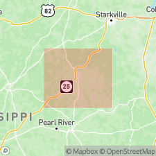
Pg. 10-19. Ackerman formation in its outcrop in Lafayette County, [Mississippi], is entirely nonmarine. On basis of data obtained from shallow exploratory holes and surface exposures, Ackerman is herein divided into four units (numbered 1 to 4 in ascending order), the composite of which forms a cyclothem. Third unit of Ackerman has probably been confused with Holly Springs formation. It is proposed that name Holly Springs be dropped from literature. Overlies Fearn Springs formation; underlies Meridian formation. Age is early Eocene.
Source: US geologic names lexicon (USGS Bull. 1200, p. 15-16); supplemental information from GNU records (USGS DDS-6; Reston GNULEX).
- Usage in publication:
-
- Ackerman formation
- Modifications:
-
- Areal extent
- AAPG geologic province:
-
- Black Warrior basin
Summary:
Pg. 10-14. Ackerman formation. Described in Talobusha County, Mississippi, as composed of sand, clay, shale, lignite, quartzite, and iron concretions. Basal sand not present at surface. Thickness 68 to 140 feet. Underlies Meridian formation. Age is early Eocene.
Source: US geologic names lexicon (USGS Bull. 1200, p. 15-16); supplemental information from GNU records (USGS DDS-6; Reston GNULEX).
- Usage in publication:
-
- Ackerman formation
- Modifications:
-
- Areal extent
- AAPG geologic province:
-
- Upper Mississippi embayment
Summary:
Pg. 25-43, pl. 1. Ackerman formation of Wilcox group. Entire Ackerman is present in Benton County, Mississippi. Thickness varies from featheredge on east to about 100 to 150 feet on west. Overlies Fearn Springs formation; underlies Meridian formation. Age is early Eocene.
Source: US geologic names lexicon (USGS Bull. 1200, p. 15-16); supplemental information from GNU records (USGS DDS-6; Reston GNULEX).

- Usage in publication:
-
- Ackerman Formation
- Modifications:
-
- Areal extent
- AAPG geologic province:
-
- Black Warrior basin
- Mid-Gulf Coast basin
Summary:
According to Hughes (1958), the "Ackerman" Formation at its type locality correlates with beds well up in the Tuscahoma Sand of Alabama and is thus unsuited as a stratigraphic term for beds of Nanafalia age. However, the Ackerman Formation as mapped by Foster (1940) in Lauderdale County is here recognized as the Nanafalia Formation. Unit lies disconformably above the Fearn Springs Member of the Naheola Formation (new allocation).
Source: GNU records (USGS DDS-6; Reston GNULEX).
- Usage in publication:
-
- Ackerman Formation
- Modifications:
-
- Overview
- AAPG geologic province:
-
- Upper Mississippi embayment
Summary:
Pg. 7-8; Missouri Div. Geol. and Land Survey, v. 40 (revised), 2nd ser., 1995. Ackerman Formation of Wilcox Group. Basal formation of the Wilcox Group. Light-gray to brown, silty, slightly lignitic, nonmarine clay. Glauconite and lenticular sandstone locally present at base. Thickness 0 to 100 feet. Underlies Holly Springs Formation. Overlies Porters Creek Clay of Midway Group. Most subsurface records do not distinguish Ackerman from the underlying Holly Springs. Most of McQueen's 1939 (Kansas Geol. Soc., 13th Ann. Field Conf.) Ackerman was found to be mainly Porters Creek, with possible remnants of true Ackerman at top. Age is Paleocene.
Source: Publication.
For more information, please contact Nancy Stamm, Geologic Names Committee Secretary.
Asterisk (*) indicates published by U.S. Geological Survey authors.
"No current usage" (†) implies that a name has been abandoned or has fallen into disuse. Former usage and, if known, replacement name given in parentheses ( ).
Slash (/) indicates name conflicts with nomenclatural guidelines (CSN, 1933; ACSN, 1961, 1970; NACSN, 1983, 2005, 2021). May be explained within brackets ([ ]).