

- Usage in publication:
-
- Accord shale
- Modifications:
-
- Original reference
- Dominant lithology:
-
- Shale
- AAPG geologic province:
-
- Appalachian basin
Summary:
Accord shale. Suggested for unfossiliferous calcareous shale underlying Rosendale waterlime. Thickness at type section 18 feet. Age is Late Silurian (Murderian) [Pridoli].
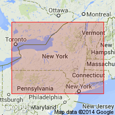
Type section: abandoned railroad cut, southern edge of Accord, Rosendale quadrangle, southeastern NY.
Source: US geologic names lexicon (USGS Bull. 1200, p. 14-15).
For more information, please contact Nancy Stamm, Geologic Names Committee Secretary.
Asterisk (*) indicates published by U.S. Geological Survey authors.
"No current usage" (†) implies that a name has been abandoned or has fallen into disuse. Former usage and, if known, replacement name given in parentheses ( ).
Slash (/) indicates name conflicts with nomenclatural guidelines (CSN, 1933; ACSN, 1961, 1970; NACSN, 1983, 2005, 2021). May be explained within brackets ([ ]).