The National Geologic Map Database is migrating to a new infrastructure. We apologize for any service disruptions during this process.
|
|---|


- Usage in publication:
-
- Accabee gravels
- Accabee phos-gravels
- Modifications:
-
- Original reference
- AAPG geologic province:
-
- Atlantic Coast basin
Summary:
[Synopsis from advance copy of South Carolina Geol. Survey geognostic map of South Carolina published 1908, in South Carolina Geol. Survey Bull., 4th ser., no. 2, and 1907, Summary of mineral resources of South Carolina, p. 6, 9, 12.]
Accabee gravels (also Accabee phos-gravels). Resting on Bohicket marl sands a bed of coarse gravel (eighth-inch diameter) occurs, and embraces rounded lumps of phosphate rock and numerous quartz pebbles (2"); its littoral line overlaps and extends more northerly than Bohicket marl-sand. Along northerly exposures it attains elevation of 16 feet (M.L.T.). This bed, which is generally missing, attains in places thickness of 4 feet; it affords the irregular seam of phosphate rock known to miners as "flying rock." Is a marine deposit.
Source: US geologic names lexicon (USGS Bull. 896, p. 11).

- Usage in publication:
-
- Accabee gravels†
- Accabee phos-gravels†
- Modifications:
-
- Abandoned
- AAPG geologic province:
-
- Atlantic Coast basin
Summary:
C.W. Cooke (personal communication, 1935). †Accabee gravels (†Accabee phos-gravels). The beds described are a facies of Pamlico formation.
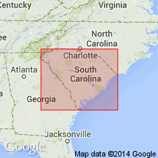
Named from exposures in pit at Corn Hill, near Accabee Flats, west of Charleston, Charleston Co., southern SC.
Source: US geologic names lexicon (USGS Bull. 896, p. 11).
For more information, please contact Nancy Stamm, Geologic Names Committee Secretary.
Asterisk (*) indicates published by U.S. Geological Survey authors.
"No current usage" (†) implies that a name has been abandoned or has fallen into disuse. Former usage and, if known, replacement name given in parentheses ( ).
Slash (/) indicates name conflicts with nomenclatural guidelines (CSN, 1933; ACSN, 1961, 1970; NACSN, 1983, 2005, 2021). May be explained within brackets ([ ]).