

- Usage in publication:
-
- Abo sandstone*
- Modifications:
-
- Original reference
- Dominant lithology:
-
- Sandstone
- Shale
- AAPG geologic province:
-
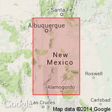
- Estancia basin
- Orogrande basin
- San Juan basin
Summary:
Abo sandstone of Manzano group (also called Abo redbeds). Coarse-grained sandstone, dark red to purple, usually conglomeratic at base; with subordinate amount of shale, which attains prominence in some places. Thickness 300 to 800 feet. Upper limit is drawn, below the gypsum, for obvious reason that in many places the overlying or Yeso formation contains beds of gypsum and gypsiferous shale at several horizons, through a thicknees in some places of 1,000 feet or more. Is basal member of Manzano group and rests unconformably upon Madera limestone of Magdalena group. Age is early Permian.
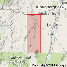
Named from Abo Canyon at south end of Manzano Range, [south and east of Topeka and Santa Fe RR, approx. Lat. 34 deg. 27 min. 30 sec. N., Long. 106 deg. 30 min. 30 sec. W., along Valencia-Torrance Co. line], central NM. [Additional locality information from ACME Mapper 2.0, accessed November 1, 2011.]
[GNC remark (ca. 1960, US geologic names lexicon, USGS Bull. 1200, p. 13): The USGS has abandoned term Manzano Group.]
Source: US geologic names lexicon (USGS Bull. 896, p. 9); supplemental information from GNU records (USGS DDS-6; Denver GNULEX).
- Usage in publication:
-
- Abo sandstone*
- Modifications:
-
- Age modified
- AAPG geologic province:
-
- Orogrande basin
Summary:
Pg. 674-676. Abo sandstone of Manzano group. In some previous reports, Abo sandstone was considered to approximate equivalent to Wolfcamp series, and supposed unconformity at its base was thought same as that at base of Wolfcamp. This correlation now seems to be incorrect. Herein suggested that Abo is mostly or wholly post-Wolfcamp and that equivalent of Wolfcamp series lies in upper part of Magdalena group as at present defined and mapped.
[GNC remark (ca. 1960, US geologic names lexicon, USGS Bull. 1200, p. 13: The USGS has abandoned term Manzano Group.]
Source: US geologic names lexicon (USGS Bull. 1200, p. 10-13).
- Usage in publication:
-
- Abo sandstone*
- Modifications:
-
- Areal extent
- AAPG geologic province:
-
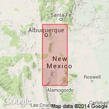
- Estancia basin
- Orogrande basin
- San Juan basin
Summary:
Pg. 20-22 [Discussion of Carboniferous System rocks by V.T. Stringfield, A.H. Koschmann, and G.F. Loughlin], pl. 2.
Abo sandstone. In Magdalena district, New Mexico, unconformably overlies Madera limestone of Magdalena group. Unconformable below Datil(?) formation. Maximum thickness about 175 feet. [Age is Early Permian (Wolfcamp and Leonard).]
Source: US geologic names lexicon (USGS Bull. 1200, p. 10-13).
- Usage in publication:
-
- Abo formation
- Modifications:
-
- Principal reference
- Dominant lithology:
-
- Sandstone
- Shale
- AAPG geologic province:
-
- Estancia basin
- Orogrande basin
- San Juan basin
Summary:
Pg. 1654-1657. Abo formation. Lee (1909) gave name Abo sandstone to succession of dark-red coarse-grained sandstones, in part conglomerate, exposed in Abo Canyon at south end of Manzano Mountains. He gave maximum thickness of 800 feet. Lee stated that Abo was underlain unconformably by Magdalena limestone (Pennsylvanian), but his definition of upper boundary is not clear. Abo was termed basal member of Manzano group, which contained (ascending) Abo sandstone, Yeso formation, and San Andres limestone. Several thin fossiliferous limestones that Lee described as lying near base of Abo are now known to belong to underlying Pennsylvanian. Lee's conclusion that shale in Abo is subordinate in amount to sandstone and conglomerate is in error. Lee did not designate type section. In type section herein designated and described, Abo consists of about 60 percent red shale and about 40 percent sandstone, arkose, and conglomerate. This ratio holds approximately true for most exposures in central New Mexico. It is incorrect to refer to formation as Abo sandstone. Thickness 915 feet at type section. Overlies unnamed basal Permian limestone; underlies Yeso (redefined). [Age is Early Permian (Wolfcamp).]
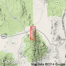
Type section [composite]: from base of formation in sec. 32, T. 3 N., R. 5 E., Valencia Co., just north of U.S. Highway 60, through sec. 33, into sec. 2, T. 2 N., R. 5 E., to upper limit of formation at top of hill just east of road to Abo Ruins in sec. 25, T. 3 N., R. 5 E., Torrance Co. Base of section lies about 1 mi northwest of village of Scholle; top lies about 2 mi west-northwest of village of Abo.
Source: US geologic names lexicon (USGS Bull. 1200, p. 10-13).
- Usage in publication:
-
- Abo formation*
- Modifications:
-
- Mapped
- AAPG geologic province:
-
- Estancia basin
- Orogrande basin
- San Juan basin
Summary:
Abo formation. In Lucero uplift, Valencia, Socorro, and Bernalillo Counties, New Mexico, consists of red-brown, fine- to coarse-grained sandstone, siltstone, and shale with occasional thin limestone and limestone-pellet beds. Overlies and intertongues with Pennsylvanian Red Tanks member (new) of Madera limestone of Magdalena group; underlies and intertongues with Permian Meseta Blanca sandstone member of Yeso formation. Age is considered Permian(?).
Source: Publication; US geologic names lexicon (USGS Bull. 1200, p. 10-13).
- Usage in publication:
-
- Abo formation
- Modifications:
-
- Areal extent
- AAPG geologic province:
-
- Orogrande basin
Summary:
Abo formation. In Los Pinos Mountains [Socorro County, central New Mexico], Abo formation disconformably overlies Aqua Torres formation (new). Thickness exceeds 500 feet.
Source: US geologic names lexicon (USGS Bull. 1200, p. 10-13).
- Usage in publication:
-
- Abo formation*
- Modifications:
-
- Mapped
- AAPG geologic province:
-
- Estancia basin
- Orogrande basin
Summary:
Abo formation. Consists of dark-red shale, dark-red sandstone and arkose, conglomerate, and lime-pellet conglomerate. Thickness ranges from 300 feet in Joyita Hills to 910 feet in type section. Overlies Bursum formation (new) [tentatively assigned to Magdalena group]. Age of formation is in question. Fossil plants (collected and identified by C.B. Read, USGS) indicate at least upper part should be correlated with strata of Leonard and not Wolfcamp age [Early Permian]. Age is considered Carboniferous(?) to Permian.
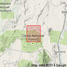
Notable exposures along Torrance-Socorro Co. line in Cibola National Forest.
Source: Publication; US geologic names lexicon (USGS Bull. 1200, p. 10-13).
- Usage in publication:
-
- Abo formation*
- Modifications:
-
- Mapped
- AAPG geologic province:
-
- San Juan basin
Summary:
Abo formation. Clastic rocks deposited on old floodplains. Mapped south of Lat. 36 deg. N., in Sandoval and Rio Arriba Counties, New Mexico; north of that latitude, strata are included in Cutler formation (Permian). Overlies Madera limestone of Magdalena group (Pennsylvanian); underlies and intertongues with Meseta Blanca sandstone member (new) of Yeso formation (Permian). Age is doubtful Permian(?).
Source: Publication; US geologic names lexicon (USGS Bull. 1200, p. 10-13).
- Usage in publication:
-
- Abo formation
- Modifications:
-
- Revised
- AAPG geologic province:
-
- Estancia basin
- Orogrande basin
- San Juan basin
Summary:
Pg. 15 (fig. 2), 26-28, pl. 1. Abo formation. In Gran Quivira quadrangle, Socorro, Torrance, and Valencia Counties, central New Mexico, consists of red shale, red slabby sandstone, and dark-red arkose, with mud cracks, ripple marks, and cross-bedding. Thickness 810 feet. Underlies Meseta Blanca member of Yeso formation; overlies Bursum formation. [Age is Early Permian (Wolfcamp and Leonard).]
As described by Needham and Bates, Abo in Abo Canyon, consists of 914 feet of continental red beds that overlie a thin "unnamed basal Permian limestone." Fieldwork for present report shows that this limestone is at top of Bursum formation. Uppermost unit of type Abo of Needham and Bates is a 6-foot white massive sandstone. Further work in Gran Quivira quadrangle has shown presence, just above this sandstone, of a thin limestone that is identical with lowest unit of Yeso as redefined by Needham and Bates. It has been pointed out by C.B. Read (personal commun.) that basal Yeso limestone cannot be found in Yeso sections in northern part of state (e.g., in Glorieta Mesa and Zuni Mountains), and consequently cannot serve as universally recognizable base of Yeso. Read states that a 100- to 300-foot section of sandstones and shales, heretofore considered uppermost Abo, can be recognized and mapped regionally. Read and his workers have mapped Abo-Yeso contact some distance below basal Yeso limestone of Needham and Bates. Applied to Abo type section, this revision lowers Abo-Yeso contact 104 feet, to top of interval 32 of Needham and Bates section. Wood and Northrop (1946) have named this 104-foot section Meseta Blanca member of Yeso.
Source: Publication; US geologic names lexicon (USGS Bull. 1200, p. 10-13).
- Usage in publication:
-
- Abo formation
- Modifications:
-
- Areal extent
- AAPG geologic province:
-
- Orogrande basin
Summary:
Abo formation of Manzano group. Present in Caballo Mountains, Sierra County, southern New Mexico. Overlies Bar B formation (new) of Magdalena group; underlies Yeso formation. Contacts disconformable. Age is Early Permian (Wolfcamp).
[GNC remark (ca. 1960, US geologic names lexicon, USGS Bull. 1200, p. 13): The USGS has abandoned term Manzano Group.]
Source: Modified from GNU records (USGS DDS-6; Denver GNULEX).
- Usage in publication:
-
- Abo formation
- Modifications:
-
- Areal extent
- AAPG geologic province:
-
- Orogrande basin
Summary:
Pg. 93 (columnar section), 101. Discussion of Sacramento Mountains escarpment, southeastern New Mexico. Abo formation was deposited over entire escarpment area. In basinal area east of Tularosa, Abo is about 1,100 feet thick and composed principally of dark-reddish-brown mudstone and arkose. Here it grades into underlying latest early Wolfcampian marine strata. Thins rapidly toward positive block in southeast and is about 400 feet thick in High Rolls area. Here it is composed of basal quartzite conglomerate cobbles and an overlying thicker sequence of dark-reddish-brown mudstones and arkose. Farther south, it is 200 to 550 feet thick and splits into an uppermost and a basal series of red beds and a middle sequence composed principally of thin-bedded limestone, dolomitic limestone, and nonred shales. Middle sequence thickens southward to Hueco Mountains, changes from brackish to marine facies, and forms most of Wolfcampian part of Hueco limestone. Upper tongue of Abo red beds (entire Abo of Darton, 1928, USGS Bull. 794) can be traced nearly to Texas border, and forms Deer Mountains red shale of Hueco limestone. Throughout area, overlies angular unconformity cut on folded and faulted pre-Permian strata. Columnar section shows Abo penetrated by Pendejo tongue (new) of Hueco formation.
Source: US geologic names lexicon (USGS Bull. 1200, p. 10-13).
- Usage in publication:
-
- Abo formation
- Modifications:
-
- Areal extent
- AAPG geologic province:
-
- Estancia basin
- Orogrande basin
- San Juan basin
Summary:
Pg. 17. Abo formation. Mentioned as containing Powwow conglomerate member at base. Age is Early Permian (Wolfcampian).
Source: US geologic names lexicon (USGS Bull. 1200, p. 10-13).
- Usage in publication:
-
- Abo formation
- Modifications:
-
- Areal extent
- AAPG geologic province:
-
- Orogrande basin
Summary:
Pg. 6, 7 (fig. 2), 10, pl. 1. Abo formation. In Socorro County, central New Mexico, Abo formation conformably underlies Los Vallos member of Yeso formation. [Age is Early Permian.]
Source: US geologic names lexicon (USGS Bull. 1200, p. 10-13).
- Usage in publication:
-
- Abo sandstone*
- Modifications:
-
- Revised
- AAPG geologic province:
-
- Orogrande basin
Summary:
Pg. 689-700. Abo sandstone. Discussion of Sand Canyon area, Otero County, south-central New Mexico. Abo sandstone is divided into lower and upper tongues by interfingering with Hueco limestone. Lower tongue is herein named Danley Ranch and upper tongue Lee Ranch. About 15 miles north of area, Hueco wedges out between upper and lower parts of Abo. Rocks that previous workers have identified as Abo formation south of Culp Canyon are interpreted as distinct unit and herein named Otero Mesa member of Yeso formation. Contact with underlying Pennsylvanian rocks (Magdalena group) unconformable throughout area. Locally relief before deposition of Abo was so great that Danley Ranch tongue is absent because of nondeposition. Lee Ranch tongue is apparently early Leonard. Age is Early Permian.
Source: US geologic names lexicon (USGS Bull. 1200, p. 10-13).
- Usage in publication:
-
- Abo formation
- Modifications:
-
- Areal extent
- AAPG geologic province:
-
- Orogrande basin
Summary:
Pg. 58-71. Abo formation of Manzano group. In northern Sacramento Mountains, Abo formation overlies Labrocita formation (new) and underlies Yeso formation; locally overlies Holder formation. Thickness as much as 1,400 feet. Basal formation of Manzano group. Age is Early Permian (Wolfcampian and Leonardian).
[GNC remark (ca. 1960, US geologic names lexicon, USGS Bull. 1200, p. 13: The USGS has abandoned term Manzano Group.]
Source: US geologic names lexicon (USGS Bull. 1200, p. 10-13).
- Usage in publication:
-
- Abo Formation*
- Modifications:
-
- Revised
- AAPG geologic province:
-
- San Juan basin
Summary:
Revised in Zuni Mountains, Cibola Co, NM, San Juan basin. Lower part of Abo named as Oso Ridge Member which consists of about 30 ft of conglomerate and arkose with thin, fossiliferous limestone lenses interbedded with arkose. Nonconformably overlies Proterozoic rocks; upper part not discussed. Fossils in limestones of Oso Ridge suggest Late Pennsylvanian (Virgilian) and Early Permian (Wolfcampian) age.
Source: GNU records (USGS DDS-6; Denver GNULEX).
For more information, please contact Nancy Stamm, Geologic Names Committee Secretary.
Asterisk (*) indicates published by U.S. Geological Survey authors.
"No current usage" (†) implies that a name has been abandoned or has fallen into disuse. Former usage and, if known, replacement name given in parentheses ( ).
Slash (/) indicates name conflicts with nomenclatural guidelines (CSN, 1933; ACSN, 1961, 1970; NACSN, 1983, 2005, 2021). May be explained within brackets ([ ]).