The National Geologic Map Database is migrating to a new infrastructure. We apologize for any service disruptions during this process.
|
|---|


- Usage in publication:
-
- Abiquiu tuff
- Modifications:
-
- Original reference
- Dominant lithology:
-
- Tuff
- Conglomerate
- AAPG geologic province:
-
- San Juan basin
Summary:
Pg. 937 (fig. 4), 944-952, 958; see also 1937 [abs.], GSA Proc. 1936, p. 103. Abiquiu tuff. Consists of stream-laid tuff and volcanic conglomerate, with a few small interbedded lava flows; maximum thickness more than 1,000 feet. Underlies Santa Fe formation; overlies El Rito formation (new). Age is Miocene.
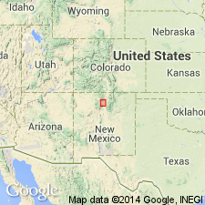
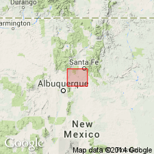
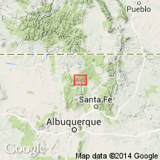
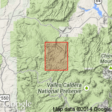
[Type locality not designated.] Named from outcrops in Abiquiu quadrangle, Rio Arriba Co., north-central NM.
Source: US geologic names lexicon (USGS Bull. 1200, p. 10).

- Usage in publication:
-
- Abiquiu tuff
- Modifications:
-
- Revised
- AAPG geologic province:
-
- San Juan basin
Summary:
Abiquiu tuff. Revised to include Pedernal Chert Member (new). Lies above unnamed gravel member and below unnamed tuff member. Age is thought to be Miocene (citing Smith, 1938).
Study area of report in Abiquiu quadrangle, Rio Arriba Co., NM.
Source: Modified from GNU records (USGS DDS-6; Denver GNULEX).
- Usage in publication:
-
- Abiquiu(?) formation
- Modifications:
-
- Areal extent
- AAPG geologic province:
-
- San Juan basin
- Estancia basin
Summary:
Name Abiquiu(?) formation assigned to lower part of late Tertiary beds in Galisteo-Tongue area, Sandia and Sangre de Cristo Mountains, Sandoval and Santa Fe Counties, north-central New Mexico. Beds are chiefly nontuffaceous. Believed to be southward extension of water-laid volcanic debris named Abiquiu tuff by Smith (1938). Thickness as much as 1,500 feet. Occurs below Santa Fe formation and above Cienequilla limburgite.
Source: US geologic names lexicon (USGS Bull. 1200, p. 10); supplemental information from GNU records (USGS DDS-6; Denver GNULEX).
- Usage in publication:
-
- Abiquiu tuff member
- Modifications:
-
- Revised
- AAPG geologic province:
-
- San Juan basin
Summary:
Pg. 83, 84. Abiquiu tuff member of Santa Fe formation. Rank reduced to member status in Santa Fe formation. Unconformably overlies El Rito formation. Thickness at least 1,350 feet on west slope of Sierra Negra. [Age is Miocene.]
Study area of report in southeastern part of Chama basin, north-central NM.
Source: US geologic names lexicon (USGS Bull. 1200, p. 10).
- Usage in publication:
-
- Abiquiu Formation
- Modifications:
-
- Areal extent
- Redescribed
- Dominant lithology:
-
- Chert
- Tuff
- Gravel
- AAPG geologic province:
-
- San Juan basin
Summary:
Abiquiu Formation. Areally extended into Jarosa quadrangle, Rio Arriba County, New Mexico. Redescribed from Abiquiu Tuff since tuff is a subordinate lithology. Comprised of (ascending): unnamed lower member, coarse gravel interbedded with coarse sand, 0 to 300 feet thick; Pedernal Chert Member, 0 to 20 feet thick; and unnamed upper member, tuff, 0 to 110 feet thick. Unconformably overlies Upper Jurassic Morrison Formation. Age is Miocene.
Source: Modified from GNU records (USGS DDS-6; Denver GNULEX).
- Usage in publication:
-
- Abiquiu Formation
- Modifications:
-
- Biostratigraphic dating
- Areal extent
- AAPG geologic province:
-
- San Juan basin
Summary:
Abiquiu Formation. Crops out on north side Jemez Mountains and Nacimiento uplift, Sandoval County, north-central New Mexico. Divided into (ascending): unnamed lower member; Pedernal "member"; and unnamed upper member. Lower member not sampled. Pedernal "member" contains COMPOSITAE pollen indicating an age not older than latest Oligocene. Vertebrate fossils in upper member are early Miocene, latest Arikareean age. Upper member is a partial equivalent of Zia Sand.
Source: Modified from GNU records (USGS DDS-6; Denver GNULEX).
- Usage in publication:
-
- Abiquiu Tuff*
- Modifications:
-
- Overview
- AAPG geologic province:
-
- San Juan basin
Summary:
The Abiquiu Tuff in westernmost part of Espanola basin, Rio Arriba Co, north-central NM in San Juan basin, has been difficult to date. Miocene pollen were reported from Abiquiu by Woodward (IN Broomfield [thesis], 1974), but no vertebrate fossils have been found. Formation contains neither clean air-fall tephra layers useful for fission-track dating nor any interbedded volcanic rocks. A dike that cuts the Abiquiu was reported as 9.8 m.y. old by Bachman and Mehnert (1978). Another dike that cuts Abiquiu and a volcanic rock clast from a monolithologic gravel bed with Abiquiu give older ages: 15.9 +/-0.9 m.y. and 17.3 +/-0.8 m.y. respectively. Gravel bed is in a fault block, but appears to be within about 10 m of top of formation. Abiquiu is close in age to part of Los Pinos Formation to north, but stratigraphic relations not well defined. Lipman and Mehnert dated Los Pinos at a range of from 25 to 5 m.y. Bingler (1968) reported an age of 25.9 +/-1.8 m.y. for a rhyolite welded tuff close to base of Cordito Member (upper member of Los Pinos). These ages support the correlation of upper part of Abiquiu with part of Cordito Member of Los Pinos.
Source: GNU records (USGS DDS-6; Denver GNULEX).
- Usage in publication:
-
- Abiquiu Formation
- Modifications:
-
- Overview
- AAPG geologic province:
-
- San Juan basin
Summary:
Abiquiu Formation. In Rio Arriba County, New Mexico, divisible into lower member, Pedernal Member, and upper member. Total thickness 300 m. Lower part of formation derived from Precambrian source to northeast. Upper part derived from intermediate to silicic volcanic source to north. Caliche and chert as a result of weathering formed between these two parts. Areal extent maps for three members shown. Transport direction changed from southwest (lower part) to southeast (upper part). Age is Oligocene to Miocene.
Source: Modified from GNU records (USGS DDS-6; Denver GNULEX).
For more information, please contact Nancy Stamm, Geologic Names Committee Secretary.
Asterisk (*) indicates published by U.S. Geological Survey authors.
"No current usage" (†) implies that a name has been abandoned or has fallen into disuse. Former usage and, if known, replacement name given in parentheses ( ).
Slash (/) indicates name conflicts with nomenclatural guidelines (CSN, 1933; ACSN, 1961, 1970; NACSN, 1983, 2005, 2021). May be explained within brackets ([ ]).