The National Geologic Map Database is migrating to a new infrastructure. We apologize for any service disruptions during this process.
|
|---|


- Usage in publication:
-
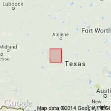
- Abilene formation
- Modifications:
-
- Original reference
- Dominant lithology:
-
- Limestone
- Clay
- AAPG geologic province:
-
- Permian basin
Summary:
Pg. 95-96, pl. Abilene formation. Thin fossiliferous limestones separated by red and blue clays. Thickness 170 feet. Top member of Wichita beds. Occurs around Abilene, [Taylor County, Texas], and perhaps southward beneath Callahan Divide. Thins out and disappears to north, but underlying Lueders limestone persists to within a few miles of Red River. [Age is Permian.]
Source: US geologic names lexicon (USGS Bull. 896, p. 9).
- Usage in publication:
-
- Abilene formation
- Modifications:
-
- Not used
- AAPG geologic province:
-
- Permian basin
Summary:
Pg. 45-46. [Abilene formation (preoccupied) not used.] The term Arroyo formation is given to series of soft limestones, marls, shales, and gypsum, 260 feet thick in Runnels County, Texas, which occur on and near Los Arroyo, 2.25 miles west of Ballinger. There is one persistent bed of gypsum in lower part of formation, and some shales are red. It is apparently the same set of rocks to which Wrather [1917] applied Abilene formation in Taylor County, Texas, but that name had already been used for other formations and Arroyo is substituted for it. The correlation of upper part of formation with the limestone at the standpipe at Abilene was substantiated by W.A. Riney. This formation is tentatively placed as top member of Wichita stage. Differs considerably from underlying Lueders formation.
Source: US geologic names lexicon (USGS Bull. 896, p. 9).

- Usage in publication:
-
- Abilene formation†
- Modifications:
-
- Abandoned
- AAPG geologic province:
-
- Bend arch
- Permian basin
Summary:
Pg. 169, 175. The preoccupied name Abilene formation is discarded, and replaced with Arroyo formation, basal formation of Clear Fork group. Arroyo formation occurs in north-central Texas and includes (in ascending order) Rainey limestone, Lytle limestone, and Standpipe limestone members. Underlies Vale formation of Clear Fork group, and overlies Lueders formation of Wichita group. Age is Permian.
Source: Publication; US geologic names lexicon (USGS Bull. 896, p. 9); supplemental information from GNU records (USGS DDS-6; Denver GNULEX).
For more information, please contact Nancy Stamm, Geologic Names Committee Secretary.
Asterisk (*) indicates published by U.S. Geological Survey authors.
"No current usage" (†) implies that a name has been abandoned or has fallen into disuse. Former usage and, if known, replacement name given in parentheses ( ).
Slash (/) indicates name conflicts with nomenclatural guidelines (CSN, 1933; ACSN, 1961, 1970; NACSN, 1983, 2005, 2021). May be explained within brackets ([ ]).