- Usage in publication:
-
- Abbeville-York zone
- Modifications:
-
- Original reference
Summary:
[Synopsis from advance copy of South Carolina Geol. Survey geognostic map of South Carolina published 1908, in South Carolina Geol. Survey Bull., 4th ser., no. 2, and 1907, Summary of mineral resources of South Carolina, p. 6, 9, 12.]
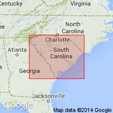
Abbeville-York zone (Archean). This area is very wide along its northerly boundary, which is constituted by State line, but narrows along its southwestern boundary, formed by Savannah River. Is bounded on northwest by Cherokee and Anderson-Spartanburg zones; on southeast by a line which proceeds southwesterly from a point on State line 1.5 miles northwest of Hornsboro, thence crossing Lynches River 1.8 miles above mouth of Rocky Creek, thence to Heath Springs, thence below Peays Ferry (Wateree River) by Longtown, thence to head of Sawneys Creek, thence across Broad River (above its confluence with Little River), thence south of Little Mountain, thence north of Culbreath Mine, thence north of Meeting Street (2 miles), and thence direct to a point near McCormick, whence it continues to Savannah River, south of mouth of Little River. Marble, of seeming upper Cherokee equivalence, appears along upper limit of Abbeville-York zone interruptedly from east side of Enoree River to east side of Saluda River. Rocks consist of gneissoids, granite, syenite, quartz, mica and hornblende schists and slates, quartzite, gabbro, trachyte, porphyries, sericite schists, quartz monzonite schists, diorite slates, diorite, trachyte, pyroxenite, amphibolite, felsite, soapstone.
[Named from exposures in Abbeville and York Cos., northwestern SC.]
Source: US geologic names lexicon (USGS Bull. 896, p. 7).
For more information, please contact Nancy Stamm, Geologic Names Committee Secretary.
Asterisk (*) indicates published by U.S. Geological Survey authors.
"No current usage" (†) implies that a name has been abandoned or has fallen into disuse. Former usage and, if known, replacement name given in parentheses ( ).
Slash (/) indicates name conflicts with nomenclatural guidelines (CSN, 1933; ACSN, 1961, 1970; NACSN, 1983, 2005, 2021). May be explained within brackets ([ ]).

