The National Geologic Map Database is migrating to a new infrastructure. We apologize for any service disruptions during this process.
|
|---|


- Usage in publication:
-
- Aaron slate
- Modifications:
-
- Original reference
- Dominant lithology:
-
- Slate-like
- AAPG geologic province:
-
- Piedmont-Blue Ridge province
Summary:
Pg. 15, 19-27, and map. Aaron slate. A slate-like rock formed by mixtures of varying amounts of andesitic volcanic ash and ordinary land waste, which through pressure and other agents of metamorphism have been changed or altered into a kind of hybrid slate, in some places into a schist. Varies from nearly pure greenstone to fairly pure argillaceous sandstone and slate, and in certain places is decidedly conglomeratic. The rock is by no means normal slate, and term "slate" was applied to it only after much hesitation and many vain attempts to find a better name. In field work called "sandy tuff." It immediately overlies Hyco quartz porphyry. Age is Ordovician(?).
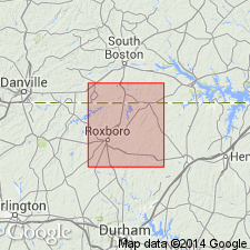
Is well exposed at many places along Aaron's Creek, [Person and Granville Cos., central northern NC].
Source: US geologic names lexicon (USGS Bull. 896, p. 7).
- Usage in publication:
-
- Aaron slate
- Modifications:
-
- Revised
- AAPG geologic province:
-
- Piedmont-Blue Ridge province
Jonas, A.I., 1928, Geological map of Virginia; preliminary edition: Virginia Geological Survey
Summary:
[The block of pre-Cambrian extrusive rocks younger than Glenarm series and designated "greenstone volcanics" is stated to include a porphyritic amygdaloidal and tuffaceous facies called Aaron slate.]
Source: US geologic names lexicon (USGS Bull. 896, p. 7).
- Usage in publication:
-
- Aaron slate
- Modifications:
-
- Areal extent
- AAPG geologic province:
-
- Piedmont-Blue Ridge province
Summary:
Pg. 17. Aaron slate. In Pittsylvania and Halifax Counties, overlies Hyco quartz porphyry. Varies from nearly pure greenstone to fairly pure argillaceous sandstone and slate; in some areas decidedly conglomeratic. Age is Paleozoic or Precambrian.
[Misprint: US geologic names lexicon (USGS Bull. 1200, p. 7) cites J.L. Calver as author of Virginia Div. Min. Res. Bull., no. 75. Should be H.E. LeGrand.]
Source: US geologic names lexicon (USGS Bull. 1200, p. 7).
- Usage in publication:
-
- Aaron Formation
- Modifications:
-
- Revised
- AAPG geologic province:
-
- Piedmont-Blue Ridge province
Summary:
Name of unit changed from Aaron Slate to Aaron Formation. Informally subdivided into lower slate member (914 m), middle mafic metavolcanic member (762 m), and upper slate member (no thickness given). Conformably overlies Hyco Formation. Age given as Precambrian(?).
Source: GNU records (USGS DDS-6; Reston GNULEX).
- Usage in publication:
-
- Aaron Formation
- Modifications:
-
- Redescribed
- Revised
- Age modified
- Dominant lithology:
-
- Conglomerate
- AAPG geologic province:
-
- Piedmont-Blue Ridge province
Summary:
Aaron Formation is distinctive stratigraphic marker of quartz arenite pebbles and cobbles. Middle and upper members of Aaron as defined by Kreisa (1980) are here assigned to Virgilina Formation, while Aaron is restricted to lower sedimentary member. Interpreted as deep-water, submarine fan, derived from erosion of underlying Hyco Formation. Unconformably underlies Virgilina Formation to the north and Uwharrie Formation to the south. Intruded by Roxboro metagranite (575 +/-20 Ma) and Parks Crossroads granodiorite (566 +/-46 Ma). Age is late Precambrian and Early Cambrian(?) [all maps show Aaron as late Precambrian only].
Source: GNU records (USGS DDS-6; Reston GNULEX).
- Usage in publication:
-
- Aaron Formation*
- Modifications:
-
- Overview
- AAPG geologic province:
-
- Piedmont-Blue Ridge province
Summary:
Aaron Formation is used in accordance with Harris and Glover (1988). Consists of thin beds of quartz-pebble conglomerate, fine-grained volcanic sandstone and siltstone, minor amounts of pyroclastic beds now altered to slate, metasandstone, metaconglomerate, and minor amounts of greenstone. Age is Late Proterozoic (following maps in Harris and Glover (1988) which show Aaron as late Precambrian only).
Source: GNU records (USGS DDS-6; Reston GNULEX).

- Usage in publication:
-
- Aaron Slate
- Modifications:
-
- Overview
- AAPG geologic province:
-
- Piedmont-Blue Ridge province
Summary:
Aaron herein includes the upper and lower members of the Aaron Formation of Kreisa (1980), and the Aaron Formation and upper portion of the Virgilina Formation of Harris and Glover (1985). Unit is subdivided into two map units. Upper phyllite and slate is very-light-gray, fine-grained, bedded volcaniclastic sediments, conglomerate, lithic feldspathic arenite, micaceous sandstone, siltstone, phyllite, argillite, and vitric tuff, with minor greenstone. Grayish-green slate interbedded with light-gray to grayish-green micaceous metasandstone occurs at base of this upper part. Bedding is conspicuous and graded bedding is common. Lower map unit (metaconglomerate) is metamorphosed sandy conglomerate, conglomeratic sandstone, and granule conglomerate containing pebbles and cobbles of polycrystalline quartz, with lesser diorite, diabase, chert, rhyolite, granite, schist, and quartz arenite. Cobbles are generally less than 2 cm but may range up to 25 cm in diameter.
Source: GNU records (USGS DDS-6; Reston GNULEX).
For more information, please contact Nancy Stamm, Geologic Names Committee Secretary.
Asterisk (*) indicates published by U.S. Geological Survey authors.
"No current usage" (†) implies that a name has been abandoned or has fallen into disuse. Former usage and, if known, replacement name given in parentheses ( ).
Slash (/) indicates name conflicts with nomenclatural guidelines (CSN, 1933; ACSN, 1961, 1970; NACSN, 1983, 2005, 2021). May be explained within brackets ([ ]).